 After two incredible days in Forks, visiting the beaches in La Push and exploring Ruby Beach and the Hoh Rain Forest, we climbed back on the motorcycles and headed north west– in fact, we headed to the northwestern most point of the continental U.S., Cape Flattery!
It was misty when we set out and unfortunately the rain picked up from there. We lucked out with perfect weather the first two days of our ride, but we were pretty wet by the time we arrived in Clallam Bay.
The rain let up as we turned west onto route 112 so we pulled into a little park and took turns running into the restrooms at a beachside trail to change into dry clothes before continuing on our way.
There wasn’t much traffic as we wound our way along the coast toward Neah Bay.
As we entered the reservation we came across closed roads and preparation for a 4th of July parade. We slowed down and drove through a residential area until we came to the park entrance.
Although we entered the park in good time, it was a fair drive up to the trail head. We climbed out of our gear and set out down the trail through the woods to the ocean. A guy from the Makah Tribe was there, setting out handmade walking sticks you could use on the trail and purchase for future use.
The trail was very well maintained and was equal parts packed earth and wooden boardwalk. There were several vista points along the coast with a big viewing platform at the very end.
I kept an eye out for puffin and sea life, and we did end up seeing a number of birds (unfortunately no puffins) as well as some seals. There were quite a few people, some of whom had dogs, and we had to take turns climbing the latter to the viewing platform for the full view of the water. It was gray and windy, but rugged and beautiful.


After spending some time at the point we hiked back to the bikes and set off east along the coast. It was midday so we decided to veer off at Sekiu for lunch at By the Bay Cafe.
There really weren’t many places along the way to grab a bite so I wasn’t surprised the cafe was busy. We ordered burgers and shakes and watched the clouds rolling east over the bay.
It rained a little while we were waiting for our food and talking about our afternoon drive, but by the time we finished lunch the sky was blue with big white clouds, which held out throughout the afternoon.


Refreshed from lunch, we set out for the second leg of our day-long ride along the Strait of Juan de Fuca Scenic Byway. I read several articles about this byway being a favorite of bikers, and I understand why. The windy roads make for endless twists and turns with plenty of beautiful wooded areas and countryside along the way.
It was a little overwhelming for me at times when the traffic built up behind us. I don’t like to go that fast and the speed limit was a modest 35 mph for the majority of our ride. The cars didn’t seem to think that applied to them, and they would come speeding up behind us and then pass us whenever they had a chance. Sometimes they would cut it close approaching double lines, which made me nervous.
Moments like those made me glad for our headsets so Brian could talk me through it and keep me calm. On a couple of occasions we pulled over to let a line of traffic around before we continued on.
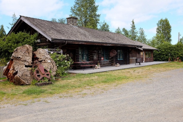
One such pull off was in Joyce, Washington, which I had heard about ahead of time. We popped in the Joyce General Store and walked over to the nearby Depot Museum, which was closed for the day.


Our last stop was the Olympic Discovery Trail outside Port Angeles. The traffic picked up and things got busier as we approached the city, and we actually passed the trailhead without seeing any sign of it. It’s very odd– the sign is small and wooden with light paint and runs alongside the road rather than perpendicular to the road like basically every other directional sign. I have no idea how you could possibly see it going 60 mph down the highway!
Luckily we turned around before we got very far and made our way back to a small, unmarked lot along the road. We climbed out of our gear one last time and set off to explore a couple miles of the trail, which actually goes across the entire Peninsula.
I read that the first couple miles had great viewpoints of the Olympic Mountains so I thought we would go a few miles out and back. That plan worked perfectly. It was getting later in the day and we didn’t want to be out in the dark, but we did want to go far enough to see a few things.
About a mile in we came across a clearing full of tall grass and beautiful purple flowers, and sure enough we could see the Olympic Mountain tops off in the distance. We took a few pictures and then continued on into the woods and up into the hills. We finally stopped at a viewpoint looking out over the mountains and got back to the bikes just in time to pack up and get to our hotel just before dark.
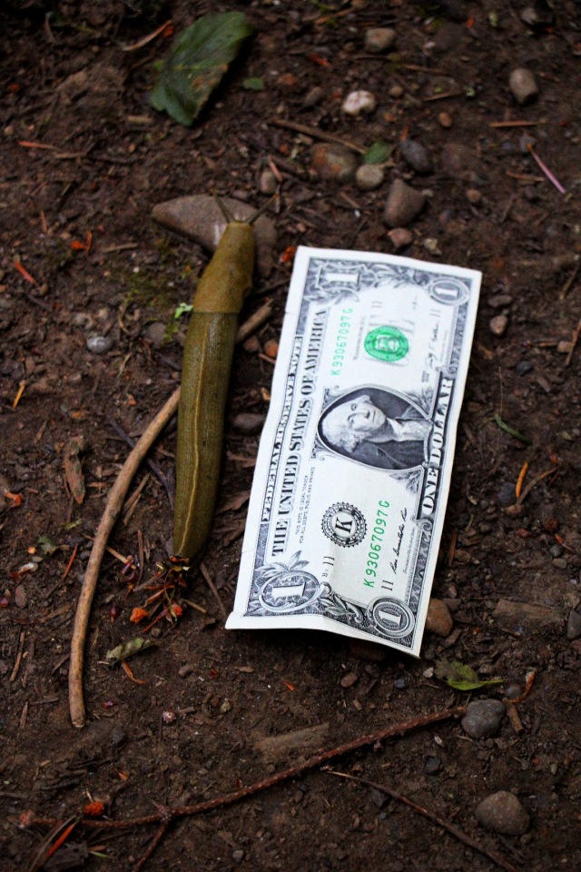
The trail was very remote– we only saw one other person the whole time, a gentleman on a bike– and we only heard fireworks shooting off every once in a while in the distance. We did come across some monster slugs that Brian pointed out right away. We put a dollar down next to one to try and capture exactly how big they were!
It was a long but really fun day. From the northwestern most point of the continental U.S. along the Juan de Fuca Scenic Byway to the entry to the Olympic Mountains National Park at Port Angeles, we experienced a range of weather, scenery, people and animals, and enjoyed another day on the bikes, connecting with nature.


Pingback: Southern Olympic Peninsula by Motorcycle – Heather's Compass
Pingback: Ports of Call: Port Angeles and Port Townsend | Heather's Compass