
I traveled to Mindoro island to make a map, and I got more than gps tracks and points when I came down from the mountains. This was the story about my journey through the forests of the Mts. Iglit-Baco National Park, to the Magcawang Ranger Station, the Tamaraw Conservation Program amidst social, and environmental challenges, and the Tamaraw Rangers who dedicate their lives to protect them.
Names of field personnel in this article were changed to protect their identity as they are under constant threat by the same people that endager our fragile environment. An international report has flagged the alarming number of dead environmental activists, conservation rangers, and indigenous rights advocates making the Philippines one of the deadliest places for those working to protect our land, sea, and air from unsustainable exploitation of its resources. Recently, an unarmed park ranger on patrol in the mountains of Palawan, considered the last frontier for biodiversity conservation; was brutally hacked to death by illegal loggers after their chainsaws were confiscated.

Map 1: 3 day excursion map from Ranger Station I to III at the Mts. Iglit-Baco National Park, Calintaan, Occidental Mindoro, Philippines.
“Look! Down beside the fallen brown tree. Do you see him?”, Tamaraw Ranger (TR) Team Leader quickly pointed out the presence of a lone Tamaraw bull grazing the valley they call Tamaraw Plaza. Sensing he was spotted. The Tamaraw stopped what he was doing and looked up at us on the ridge. I didn’t even see him not until TR Team Leader softly called my attention. TR Team Leader pointed at him 75 meters down on our right while climbing up the steep observation hill. Overlooking the plaza at this distance the bovine was no bigger than a thumb. TR Team Leader has eyes already attuned to the movement of the animal that he could spot their presence from the movement of grass, identify their sex, approximate their age, and even sometimes pinpoint individual animals with peculiar personalities.
“How do you know it was a he?” I curiously asked the veteran Tamaraw Ranger. “You could tell by the movement of their tail. A female Tamaraw continuously waves it tail to keep flies off, while a male one, keeps its tail tucked down, like protecting his rear and other precious jewels.” Laughing off with a quick burst of happiness, I shut my mouth and remained quiet as I saw the shilouette of the Tamaraw’s V shaped horns. I could see the black of his eyes. I wonder what goes through his Tamaraw mind. Questions rummaged through unfiltered ideas, like what does he see? Does he know he was in the presence of humans? What would he do if we were hunters and not observers and protectors of his domain? What was he thinking at that moment when he paused? Was it about food? The desire for procreation? Or was he simply living in the present moment? The fresh air must have cleared my polluted city brain to have entertained these thoughts.
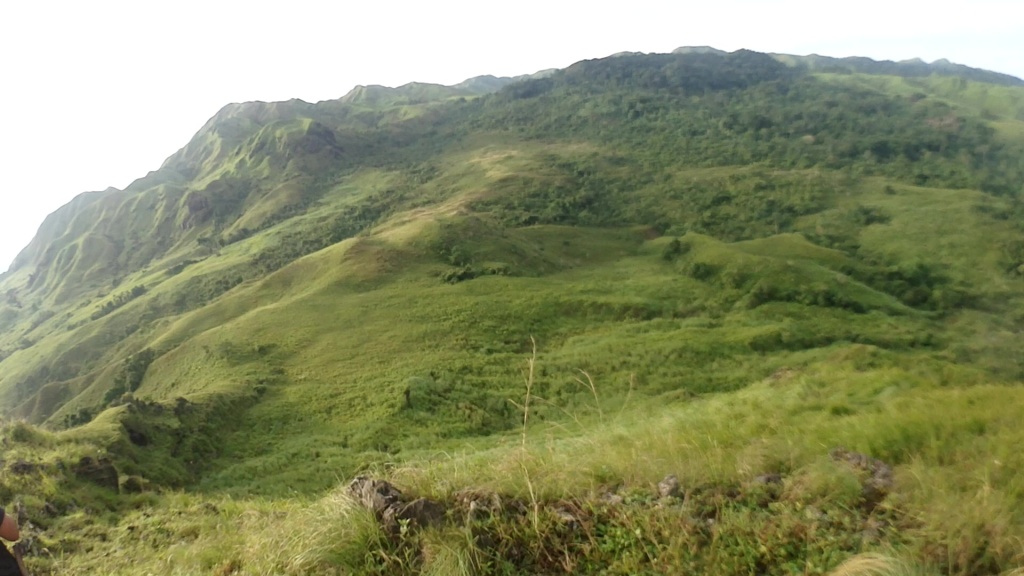
Image 1: Overlooking Tamaraw Plaza near Magcawang Ranger Station III.
The valley was the perfect location for Tamaraws to thrive, and evade humans with their herd. It was well vegetated with thick grass sometimes twice as high as their own with several spots for wallowing through charchoal grey mud. They get their water fresh near a flowing stream. The treeline was rich with variety where rangers have said the Tamaraw uses as cover from hunters. The valley was enclosed by saddles and ridges that makes the landscape below look like the bottom of a celadon bowl. This land feature forms part of a protected habitat considered sacred by the indgenous Tau-buid Mangyan. Outsiders are not allowed to tread on the valley unless accompanied by or given free, and prior informed consent by the Tau-buid Mangyan.
I started packing, unpacking, and repacking my bag, and gear for a three day excursion to Mindoro expecting rains, floods, and a light hike through grasslands. The briefer recommended to pack essentials, and bring tents as an option only because accommodations would be under bunk rooms with the Tamaraw Rangers. Food will be prepared and shared with the rangers too with what can be carried on the backs of porters. After double checking my list of things to bring, I had to leave behind my mini UAV camera since I wasn’t able to get the clearance to fly from the local army detachment (there is still an active communist insurgency in the island), and consent from the indigineous community. Even without additional drone equipment, my pack weighed 20 kg which included a tent, extra food, and 5 liters of water. Confident in my ability to carry this burden would break me barely halfway through the trail later.
Logistics coordination was coursed through an outfitter that advocates sustainable explorations by supporting conservation programs. My travel and mapping project was almost cancelled due to the intermittent monsoon, and the approaching tropical storm moving north-north-west from the Pacific. The confirmation to proceed arrived a few days before my bus departure. I booked in advanced an economy provincial bus route from Pasay City, Metro Manila to San Jose, Occidental Mindoro. The itinerary from Metro Manila to San Jose would take at least 9 hours which includes a 3-4 hour roll on-roll off ferry ride from the port of Batangas City to the Abra De Ilog port. Pro tip: book bus tickets in advance using an online/mobile platform to secure seats ahead of time, this allows you to cut ahead of the long lines at the terminals. My destination was the Mts. Iglit-Baco National Park together with the Tamaraw Conservation Program of the Department of Environment and Natural Resources. Important to remember, permits are required to enter the park and must be applied at least two weeks in advance at the Protected Area Management Unit/Office at San Jose, Occidental Mindoro. Walk-ins are highly discouraged since the safety of visitors, and the protection of the environment are of great concern by the Tamaraw rangers.
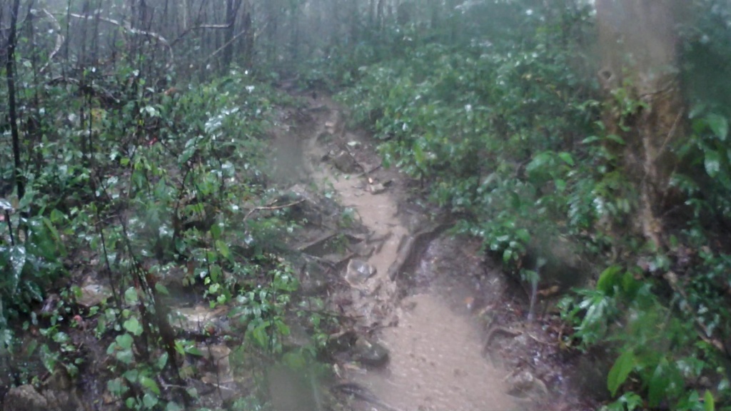
Image 2: The trails were as bad or worse than this for the next 20 km.
Mts. Iglit-Baco National Park in Calintaan, Occidental Mindoro; Philippines was declared an ASEAN Heritage Park back in 2003 to complement international effort to preserving the park’s biodiversity. Native to the land of Mindoro, the dwarf buffalo was the only endemic Philippine bovine and second largest land animal next to the Carabao. We may not have the giants or superstars of the animal kingdom popular to international wildlife conservationist, but the Tamaraw deserves attention too. While its closest cousin, the Carabao or water buffalo was a common sight in the farming villages of the Philippines, and in South East Asia, the number of Tamaraw left in the wild dwindled from the time it was documented in the early 1900s at 10,000 to as few as 400 based from the latest summer survey this year. Although the 1,000 ha Tamaraw habitat was situated within 100,000 ha of expanded nationally integrated protected areas, the Tamaraw has been categorized by the International Union for Conservation of Nature (IUCN) as critically endangered facing extremely high risk of extinction due to animal disease, persistent hunting as a food source for local inhabitants, and in the destruction of their natural habitat cleared for upland subsistence farming, settlement, and timber. Protecting both the animal and its environment was entrusted to a team of 20-25 people from the Tamaraw Conservation Program, aptly called Tamaraw Rangers.
Fun fact: The first mountaineering group to succesfully summit Mt. Iglit, one of the primary mountains of the Mts. Iglit-Baco National Park; was from the Far Eastern University whose sports team mascot was the eponymously named FEU Tamaraw. The adult Tamaraw or Mindoro Dwarf Buffalo (Bubalus Mindorensis) was about 1 m in height from hoof to shoulder, and nearly 3 m long from nose to tail. Although considered a dwarf quadropod land animal, there was nothing small about a creature with pointy V shaped horns weighing between 180-300 kilograms.

Image 3: The tree where TR Swift and his supervisor climbed up is near where this image was captured.
“Run! Run! What are you doing just standing there?! Run! Fool!” Tamaraw Ranger Swift said, expressively shouting as he recalls an encounter with an aggressive Tamaraw on his rookie year as a ranger. The incident happened on the grassy hills leading up to the Magcawang Ranger Station less than a kilometer from Ranger Station II which serves as a halfway camp for rangers, and visitors. The cogon grass that covers this landscape can grow to as high as 2 m or more. TR Senior cautioned, “Look out for fressh Tamaraw poop along the trail, and watch out for flattened grass, those are signs that a Tamaraw might be near.” Sometimes close encounters in the thick grass could spook a territorial male or the protective female which leads to unprovoked aggression. This was what happened to TR Swift while guiding his supervisor to a hike up to the observation point located at the Magcawang Ranger Station.
When a Tamaraw was about to charge, he turns his head 90 degrees to the side with the two tips of his horns pointing at the intended target. Based on the combined knowledge and experience of the rangers, they recommend doing the following when an aggressive Tamaraw was about to introduce two holes to your body.
- Drop down into a fetal position protecting your head and neck with your hands, and arms. You risk getting trampled on, but this was better than having been skewered by the animal you are protecting.
or
- Drop everything and run on either side of the charging line. You will never know how fast you can run until a 300 kg animal whose entire body can easily knock you out or worse. This option requires you are in good cardiovascular health.
Most of the time, Tamaraw’s would rather avoid any direct contact or confrontation with humans, their only natural predator. Yet, surprised by the aggressive posture of a Tamaraw over a small grass clearing, front hoof tapping up and down with a challenging exhale of hot air, and its pointy head was aiming for TR Swift and his supervisor; they had no choice but to run. Their only source of refuge was a lone tree in the middle this grassy hill. TR Swift ran so fast that he unintentionally left behind his supervisor who was still wandering, and unaware of the imminent threat. There up a leafy tree branch he shouted expletives to his boss, to stop standing, and to start running toward him and climb the tree. “I will never join you again” TR Swift’s boss remarked jokingly and anxiously as he was catching his breath after running, and climbing a tree on what would have been an uninteresting day in the field. The duo were forced to stay in the tree almost half an hour until they were sure that the Tamaraw was no longer in the area. They never made it to the Magcawang Ranger Station that day. They went back down to the previous station exhausted, and a story that would make TR Swift infamous for being the fastest runner, tree climber, and at shouting at his boss as a rookie & get away with it.
There are two trails from where people follow from Ranger Station II, and there are two kinds of people who follow each one. The summit chasers, the mountain climbers who reach the peaks of Mts. Iglit turn left, while those who have conservation purposes or would like to observe the Tamaraw turn right. I followed the latter.
The time was 0700 h. The bus finally arrived at its final destination, San Jose central terminal. My body was fighting between being awake, and being asleep at the same time. I should have allowed one whole day to rest and recuperate before making the trek on the same day I arrived. Barely rested, I found a tri-cycle to take me to the main office of the Tamaraw Conservation Program to meet the rangers, and the coordinator for this visit. The Tamaraw Conservation Program (TCP) was founded in 1979 by Executive Order No. 544 to address the need for conserving the remaining wild Tamaraw population. The TCP also attempted to artificially repopulate the Tamaraw through its on-site breeding facility which they called the Tamaraw Gene Pool. It was unsuccesful. Out of the 20 wild Tamaraws captured for the breeding program. Only 1 remains alive today. Kali, “Kalikasan Bagong Sibol”, loosely translated into english as “new hope for the environment” was born in captivity in 1999. With the failure of the breeding program, the Gene Pool facility will be converted to the Mindoro Biodiversity Conservation, Research, and Education Center in the near future.
One more hour and thirty minutes to reach the jump-off point to the Iglit-Baco National Park. “The rains have not stopped, the river was high and furious, it would be difficult.” Ma-yor said frankly. The advice came from Ma-yor, the nickname given to the local chief from one of the ethnic group of Mangyans that was waiting for us at the jump off point, also known as Ranger Station I. It would be difficult he said, difficult not impassable. True to his foreboding words, I consider this as one of the most challenging treks I’ve done. After a quick lunch, and a short history lesson about the TCP, the rangers acquired the services of a couple of Mangyans to be porters. Their strength and edurance to carry heavy loads nearly twice their size over difficult terrain amazes. In the beginning, I didn’t ask for someone to assist with my pack. I was expecting a gradual elevation gain over grassland.
My assumptions were wrong. The heavy downpour exponentiantially increased the difficulty of the route. The sky let out its agony over the trail, flooding it, turning dirt paths to sliders, and soul sucking mud. For every step I took, the mud seems to hold me down, refusing to let go. I was delaying the progress of the rear group. After more than two hours on the trail, with little progress; TR Rookie offered to carry my main pack. I humbly agreed as I underestimated the difficulty of the trail, the weather, and my own ability. He quickly blazed through the path as I carried on with my pace and around 7 kg of essential supplies, and mapping devices with me. It took more than 6 hours to walk over at least 20 km of dense forest, muddy trails, leach party streams, sketchy monkey bridges, and losing sunlight to reach Ranger Station II at 453 meters above sea level.
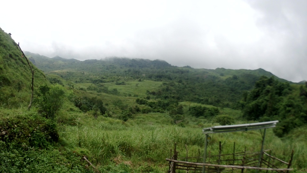
Image 4: Solar panels provide renewable energy to the Ranger Stations.
Solar panels power the bunk’s led lights, and electrical outlets allowing the group to re-charge phones, gps devices, and cameras. Forming a circle while passing around assorted candy, we hunkered down.“What do you do? Who are you? Why are you here?” Top three questions asked around during a fellowship to get to know the rangers, and me to them. I introduced myself, and told them I’m an Environmental Planner, GIS analyst, and project lead for CoMap.
The project is a Young South East Asian Leaders Initiative Seed Grant Funded project supported by the U.S. Department of State, and implemented by Cultural Vistas. The project trains youth and young professionals, develops maps, and advocates for the protection of ASEAN heritage parks. CoMap trained more than 30 people from the Philippines, and Cambodia by introducing participants to free and open source software for GIS, remote sensing, and aerial photgrammetry. The project aims to improve the knowledge, and skills of people working in environmental conservation.
So, that’s what I do. I’m the guy who geeks about maps, and in making them. But why am I here? What kind of person would put himself through the trouble of knee jerking hikes to see an animal? Love and passion for the outdoors is too simple a conclusion. But maybe that’s what is has to be. A simple love, and passion for the environment that has given so much and appreciated too little by us. Fatigue has a funny way of making you realize the important things in life. Settling in for the night involved a quick dinner, a freezing water bath, and first aid for bruises, scrapes, cuts, & leach bites. I was asleep in a matter of seconds once I lay may head over my makeshift dry bag pillow. I’ve never felt more comfortable over a dry bag.

Image 5: Makeshift pontoons to ferry us to the other side.
Waving us off at past 1300 H was the resident monkey of Ranger Station I whom the locals named Chi. I wasn’t sure what she was, but she looked like a long-tailed macaque. She was too familiar with humans and her eyes speak of curiosity with our stuff. To reach Magcawang Ranger Station some 25 km away from the jump-off point, you need to cross a couple of rivers, several streams, climb steep hills, 2 monkey bridges, several log or bamboo bridges, and thick, muddy, itchy vegetation. But first we had to pay the boatman. Due to the heavy rains upstream, the first river crossing required using the services of a makeshift pontoon made of big blue plastic barrels tied up with wooden planks, bamboo poles, and guided by a nylon rope system. Entrepreneurship at its finest right there. There’s a need (crossing raging rivers without a bridge), there’s an opportunity (floating pontoon). Who ever said that Filipinos don’t have an entrepreneurial mindset, hasn’t been around the country. The toll was ten pesos per person, roughly 20 cents in USD.
Tamaraw Rangers sign up for 22 days on patrol duty, with 8 days off. Most of the rangers started off as volunteers, joining up with the prodding of friends, or neighbors who were senior Tamaraw Rangers. Eventually their volunteerism, and passion for the environment; and the Tamaraw that they protect becomes a full time job. Some have already retired. “I will do this until I can no longer go up this mountain.” TR Senior remarked. Trying to get new personnel in to the program was limited due to budget cuts. Attracting young people to risk life, and limb for a job that does not offer social security benefits, health/life insurance, or security of tenure requires a set of qualities that were hard for me to understand. “I left my job as a contract carpenter with my brothers to be a Tamaraw Ranger, I could get paid more for a week as a carpenter than I do now as a ranger for a month. I think we do this not for the pay, although it helps with the loans, and in helping the family. We do this because we find happiness and purpose up here with the Tamaraw.” TR Carpenter has explained it perfectly.

Image 6: Monkey bridge crossing. Don’t look down.
Monkey Bridges. Another traveler gave it a nickname that mother’s would not approve. You’ll understand why in a bit. There was no other way to cross the river at the time. The water was turning violent, and foaming as it crashes on the rocks. The “bridge” was 3 m off the ground tied end to end to a tree. Three relatively thin aluminum/steel cable wires make up the bridge arranged in an inverted V. Team Leader went across, he did it like he was just walking home. “Your turn.” suggested by TR Senior behind me. Exhaling my nervousness quickly I climbed the tree linking the bridge from my end to the next. Once up there, the bridge was moving as you move. It would move on all directions, up-down, left-right from the wind, and from my shifting weight. You cannot avoid thinking of what would happen if you slip and fall down the rocky river below. Right at the middle of this so-called bridge, I paused. I looked left to right admiring this river from this shaky perspective. How many people have crossed it and nothing bad happened? I was comforted by the notion, that others have came before, and nothing bad happened to them. It was easy to regain strength and confidence to cross a difficult challenge if you have others ahead and behind you supporting you on your every step. Infinity existed for 7 minutes. And this was just the beginning.
There was a loud thud on the roof. A tree branch or something must have fallen off it, but ther was no tree nearby. The sound followed a hollow crack in the wind. It wasn’t lightning. Shots were fired. They had no idea who was shooting at them or where they were coming from, and why they were firing at them. Bullets were hitting the roof of their bunks at Ranger Station IV located near the valley to Mt. Iglit. “Get down! Get down!” TR Team Leader recalls ordering one of his men to get down. But the man who refused to get down was pre-occupied. By instict, this guy grabbed a pot of rice cooking over their fire stove before he got down on the floor. He said something like, its better to have something to eat than waste the rice if bullets hit it. I couldn’t believe it. You are either very brave or very hungry to do something like that. Not having to eat is just another hazard risk they have to deal with. The job comes with it a long list of threats from hunters, loggers, settlers, and getting caught between insurgents, and the army pursuing them. Boredom too becomes a problem. Tamaraw Rangers take 2 hour shifts to patrol around camp, passing the time on what seems like forever in the mountains can test the limits of the most stoic man.
Image 7: We spotted at least 20 Tamaraws down there.
“We may not have the best equipment, or sometimes don’t have any equipment to do our job, our salaries may be late or may be not enough to support ourselves or our families, but we still do it because we love what we do, and we appreciate the gratitude given by visitors like you.” TR Pink expressed his sentiments. He was one ranger I remember remarkably that could pull off a pink shirt, while clearing thick bush with a bolo. Doing wildlife conservation takes a toll not only on oneself but to the whole family too. The rangers have shared how many married rangers have seperated from their wives and family after being away from them for too long. It has been an open joke among them, that once their spouse leaves the Philippines to be an OFW (Overseas Filipino Worker); it was time to go down the mountains or find a new wife. These rangers may not be OFWs, but they work like one as mountain men having to leave their homes for nearly a month at a time. They told me about this one legendary Tamaraw Ranger who has retired recently that spent 1 year in the mountains without going down once, living off the land, and becoming a true lone ranger at his post. It was said that he started looking like a hermit, refusing to abandon his station. He only went down once to collect his pay and go back home to his family, only to return for another duty rotation.

Image 8: Mt. Iglit-Baco on the background, while Mt. Bayombong is on the foreground.
I could understand why someone would stay in these mountains. I’ve only spent a few days there, and I’m already itching to get back up. The beauty of Mts. Iglit-Baco National Park humbles you in the presence of these giant mountain ranges. The mountains here have summits at more than 2,000 meters above sea level. You could see clouds move in waves over ridges. You could hear silence, accented only by the sounds of nature. Your ears could pick out the songs crickets sing, the buzzing of flies as they passby, the rustling of grass as the wind touches its tip, and the roar of the rivers below. At night, on a clear sky; you are rewarded by the same starlight the ancestors once looked upon. All of this natural wonder, this wildness comes at a cost. And for middle-income countries like the Philippines, the cost is always too high in terms of budget, and personnel. There simply isn’t enough for a government having to contend with other social, economic, and environmental situations. Advocating for the improvement on the well-being not only of Tamaraw Rangers, but of all park rangers, and wardends spread across more than seven thousand islands would be a start.
Mr. Francis Josef Gasgonia is an independent Environmental Planner and GIS Analyst from Metro Manila, Philippines. You may follow him on instagram @the.lost.cartographer or at boondocksandcities.com. e-mail: info.boondocksandcities@gmail.com
