
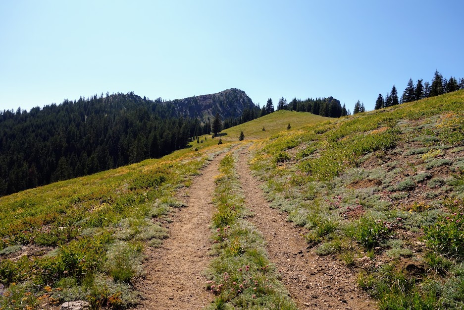
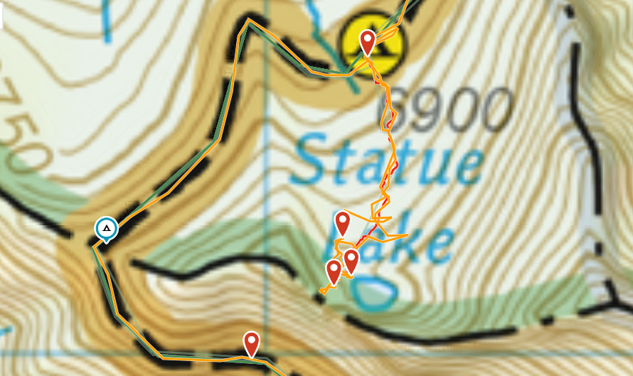
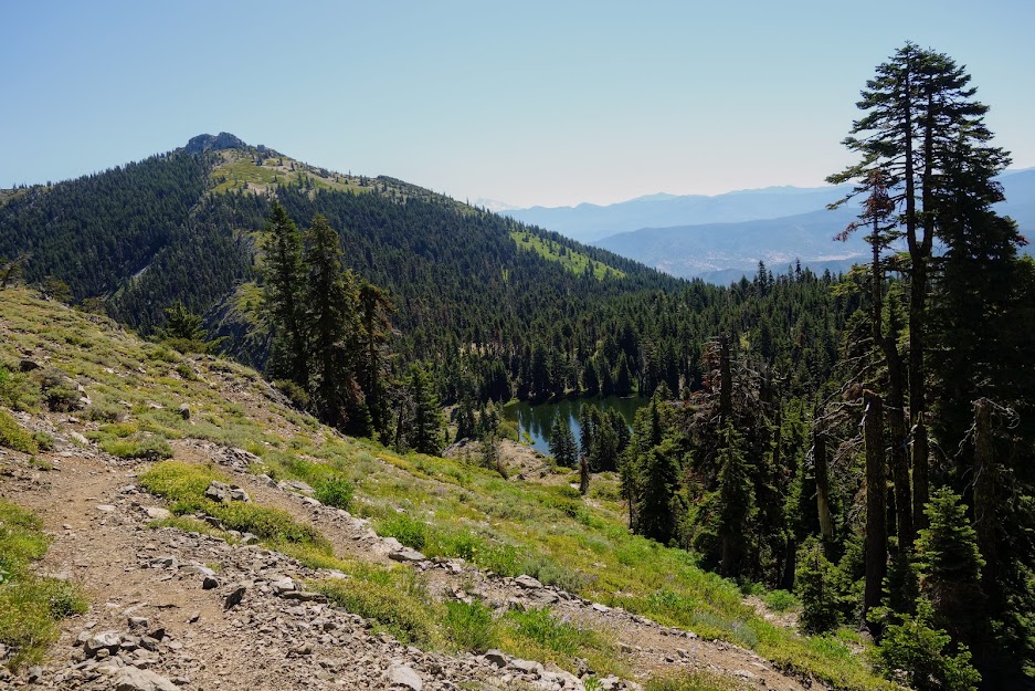
We have high routes and peakbagger routes, so why not a swimmer’s route? I was craving some time on the PCT after my recent travels on unmaintained trails in the Trinity Alps, and thought it would be fun to visit some lakes adjacent to the PCT. I started hiking north from Carter Summit off National Forest Road 93, PCT mile marker 1580.

1. Siphon Lake
My first detour was a side trail to Siphon (or Syphon), Water Dog (or Waterdog) and Russian Lakes. It’s less than a mile from the PCT to Siphon Lake and another to the junction of Deacon Lee Trail. The sign shows the spelling with a Y but the maps, guidebook and online references indicate an I.

From the PCT, this lake rates high on the ease of access scale.
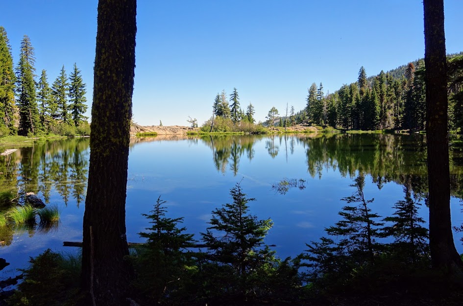
I had good intention of swimming in Russian and Waterdog Lakes but after a late start from the trailhead and lollygagging a bit too much at Siphon, I had to turn around after hiking to the Deacon Lee Trail junction. It looked to be quite a descent and since it was already 7pm I knew I was pushing my luck so those lakes will be saved for a future trip. There is a cairn route to Russian Lake about halfway between Siphen and Waterdog Lakes thus I at least got this photo of Russian Lake and Peak.
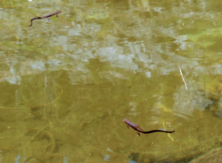
I camped at Siphen Lake and had a great swim. There were plenty of fish and newts. I wandered around finding evidence of previous siphening activity in the form of pipes. I was told by a local rancher that the lake was used for nearby mining however I also saw online that it was used for agriculture purposes. I tend to believe the mining theory as Foster Mine is in close proximity. There is a well established camp near the lake so I’m guessing it’s quite popular with the equestrian crowd. Although I had the place to myself I wouldn’t count on it.
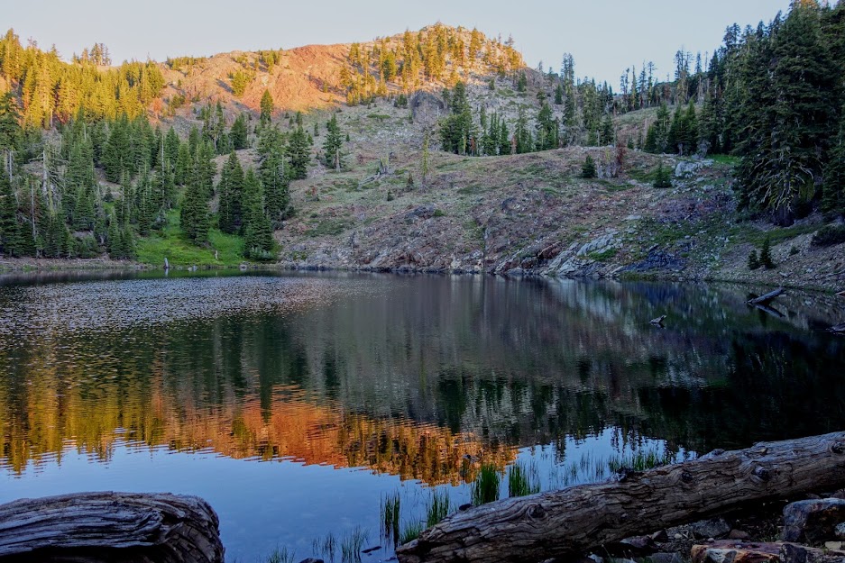
2. Bingham Lake
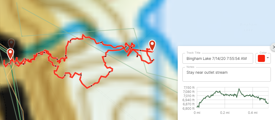
Since I was doing an out-and-back hike, I visited this lake on my return trip. It involves a rocky scramble following cairns. I got off track on my way, going up higher than needed. Tip: the route takes you up the rock pile then to the right into the woods then back to the rock pile then stays near the outlet creek. It’s about .25 mile to the lake from the PCT. There are numerous campsites and it appeared to be a moderate use lake. On the morning of my swim, I had the lake to myself.
The lake was a perfect swimmer’s paradise. With a nice rocky entrance, deep clear water, and great temperature even for this 8am swim. The sun was in my face so I couldn’t get great photos. For those interested in peakbagging, you start from Bingham Lake to summit Russian Peak.
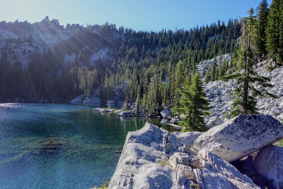
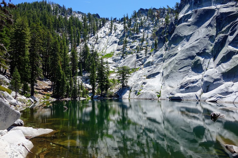
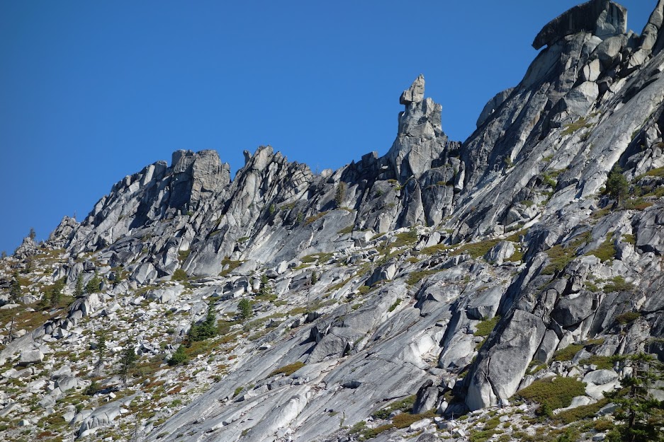
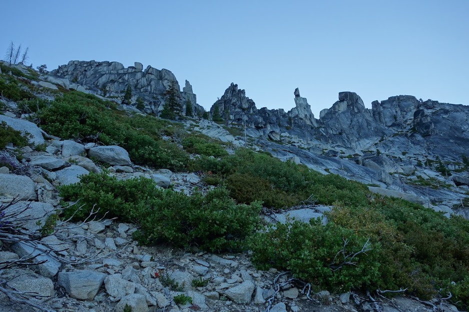
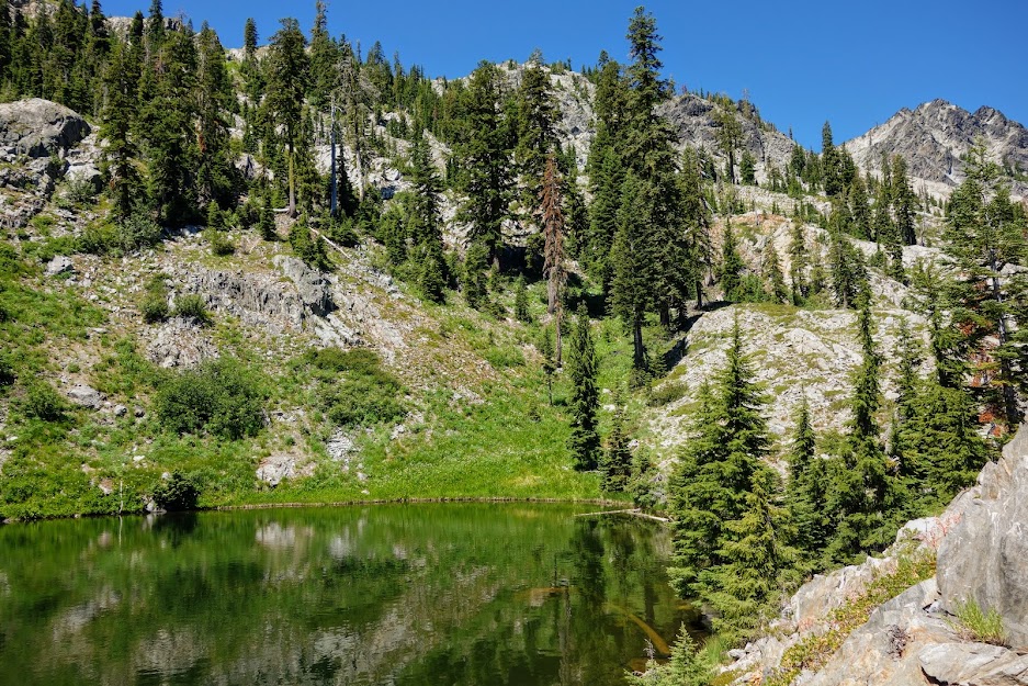
3. Statue Lake
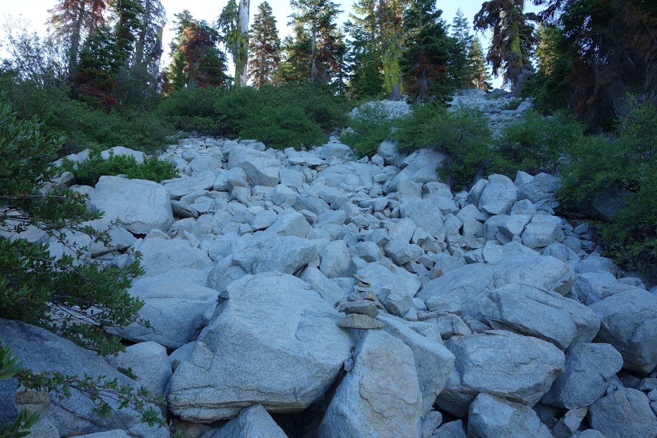
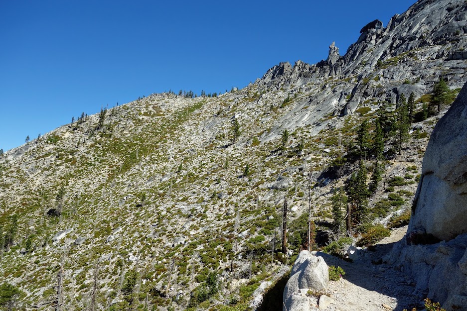
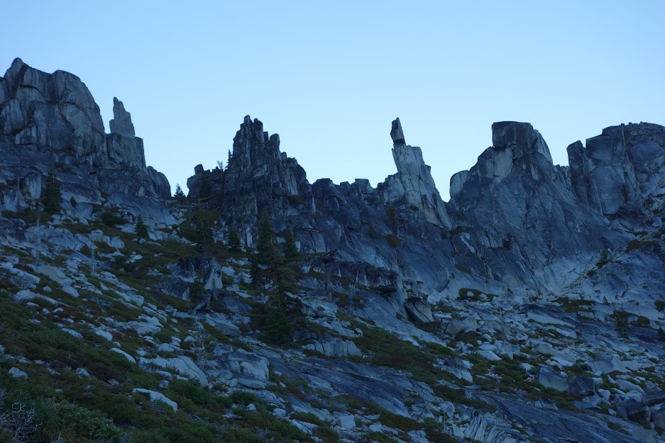
This is one of the more challenging lakes to access. There are at least three ways to reach the lake. The most common is from Statue Creek which is the way I hiked. There is a cairned trail starting where the creek crosses the PCT. Sadly this area was devastated in the 2014 fire making the unmaintained trail a bit of a mess. I got off track a few times but ultimately found myself faced with a wall of huge boulders which needed to be navigated prior to reaching the lake. When I found a campfire ring I figured I was in the right place. It was a little less than one mile and 400 feet elevation gain from the PCT to the lake.
The lake is behind this ridge. You can see the PCT traversing about one third of the way down. Where the PCT rounds the corner is supposedly one option for access. I camped at this spot one night in hopes of finding the access but with the burn you’d have to be really motivated to work your way through the boulders, dead brush and down trees.
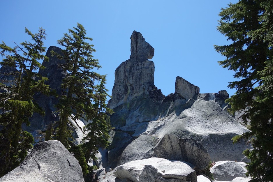
The statue of Statue Lake.
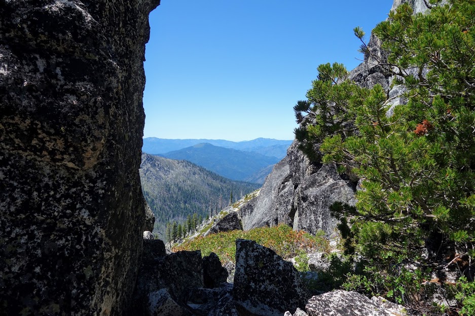
From the lake I hiked up to this secret passage.
On my return trip I looked for it from the PCT and upon finding it, my thought was there was a reasonably direct route up the front side and through the notch.
4. Paynes Lake
This is a no brainer stop as it’s right on the trail. There are plentiful campsites although it can be busy as they are used by both PCT hikers and others accessing the area from several nearby trailheads. I was happy to capture this early morning alpenglow view. You can also reach Albert (aka Albers) Lakes from a nearby unmaintained trail. Since I’d visited Lower Albert previously I skipped on this occasion; Upper Albert is still on my list but I remember the manzanita bushwhack and am not very excited at the prospect (blog link).
5. Smith Lake
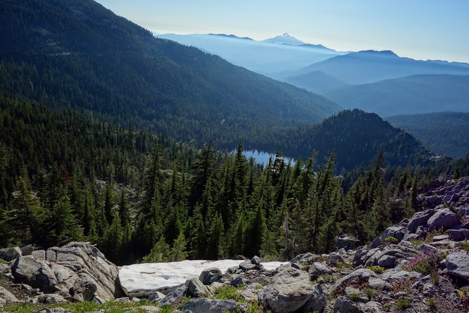
I looked for use trails as I hiked north with plans to swim on my return trip. I found a cairn marking the route along the PCT at the far northern end which is ultimately the route I followed. This is the view of Smith Lake from the PCT looking east toward Mt Shasta.
It was a steep descent but much less worrisome than Man Eaten as the footing was solid. By the time I reached this tree I was disheartened to see how much further I had to descend especially when I looked over and saw an even steeper route.
At this point I decided I better turn on my tracker so I could find my way out. Since I don’t have a clean recording I’m guessing it was about 500′ in 1/3 mile.
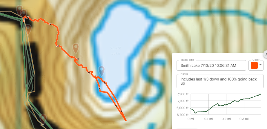
But finally I was almost there.
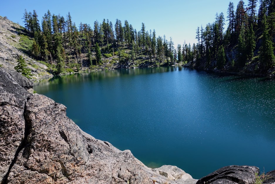
It was another perfect swimming lake! I found a campfire ring but zero indication of any flat area appropriate for camping.
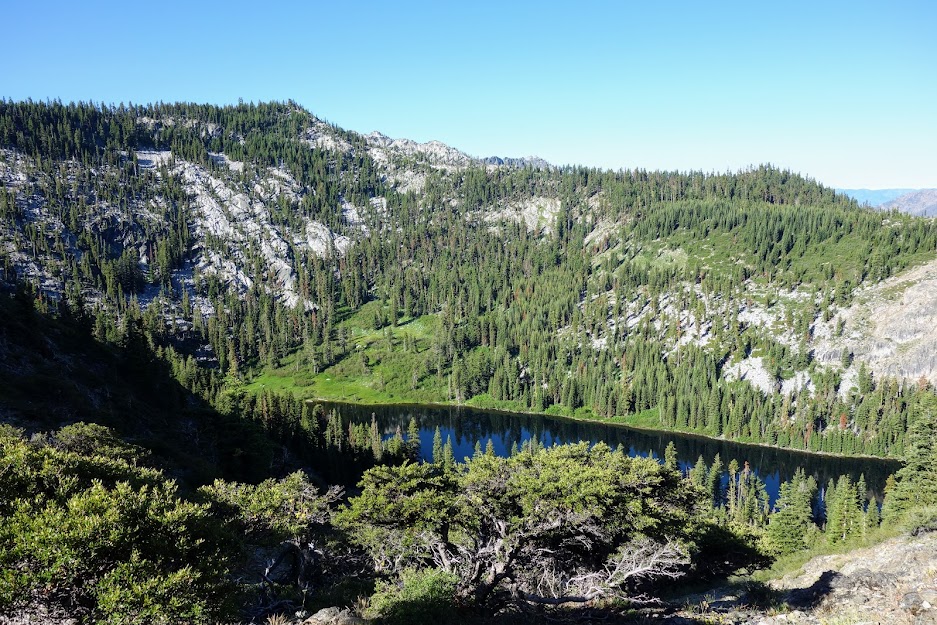
6. Ruffey Lake
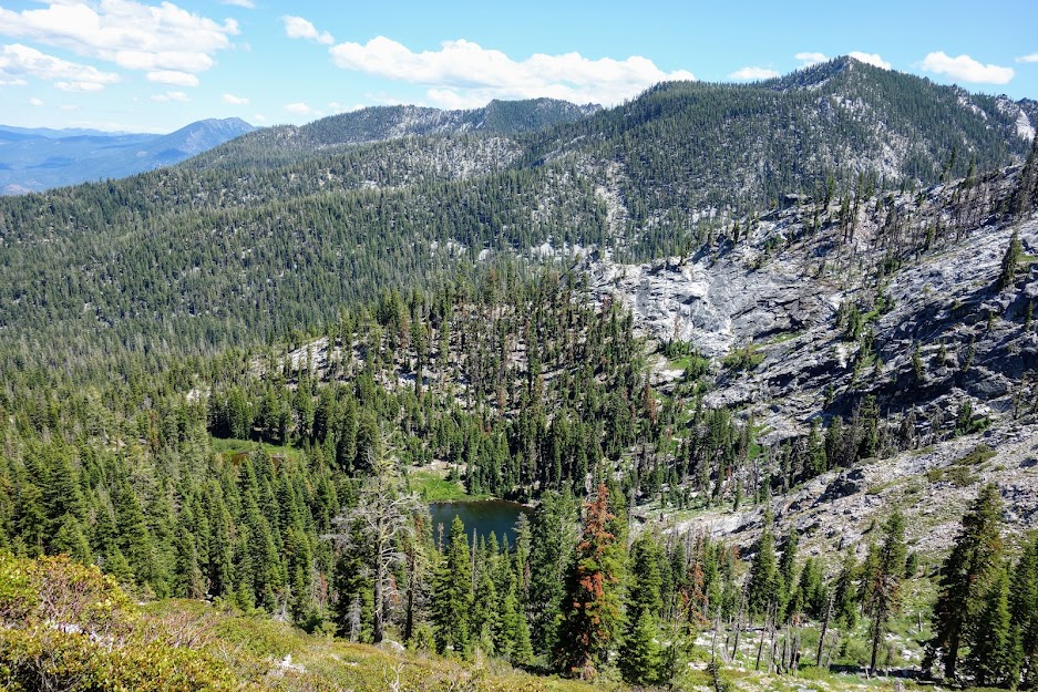
This is a popular day hike trail from the Etna Summit trailhead. The trail is in excellent condition appearing to have been recently maintained. The switchbacks were reasonably graded although you still descend 350 feet in about a half of mile. This view includes both Ruffey Lake and Etna Mountain.
The best place to swim is the rocky side of the lake, shown below in the distance. There’s an easy use trail around the lake and a short-cut trail straight down off the main trail.
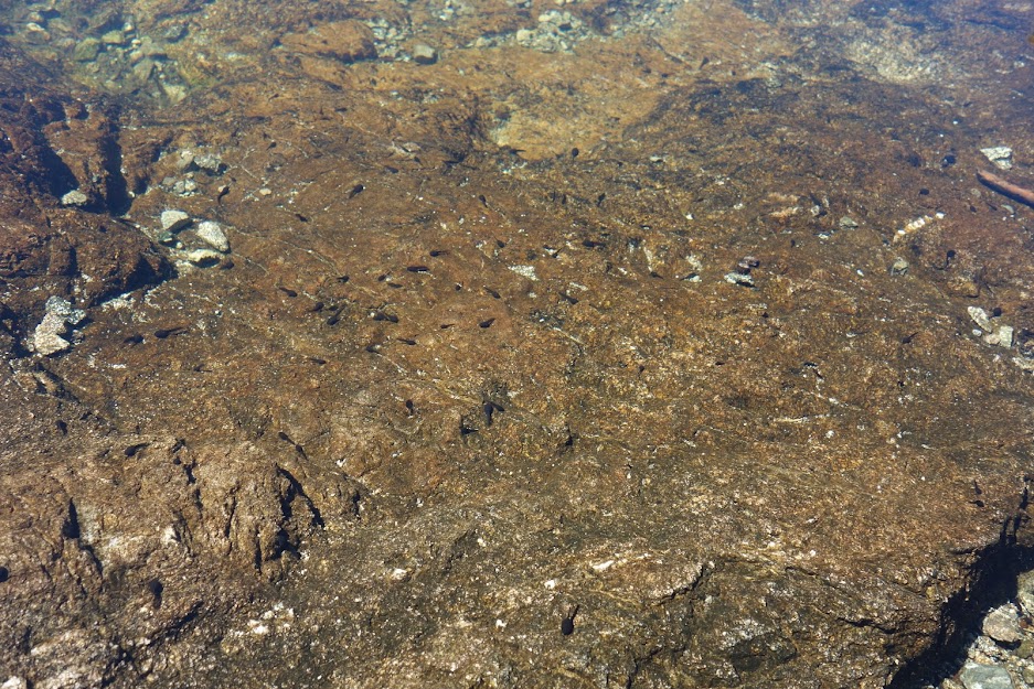
There were tadpoles, guppies and fish near where I swam. This lake is a bit more mucky than some and I’m sure gets worse as the summer progresses. On this day like most of the other lakes I visited I had it to myself and I found it perfect for swimming.
7. Fisher and Marten Lakes
It’s a long dry 14-mile hike from Etna Summit to these lakes. I would revise this route to exit at Etna Summit and get back on at another trailhead such as Kelsey Creek or Shackleford Creek. I enjoyed a great swim in Fisher Lake which is right next to the PCT. It’s another lake that is fairly shallow and could be muddy a little later in the summer. It’s twin is Marten just a short distance away, also along the PCT.
Newts are like an aquatic lizard.
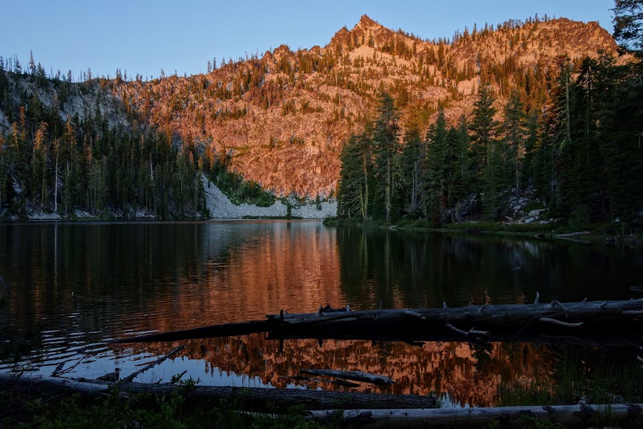
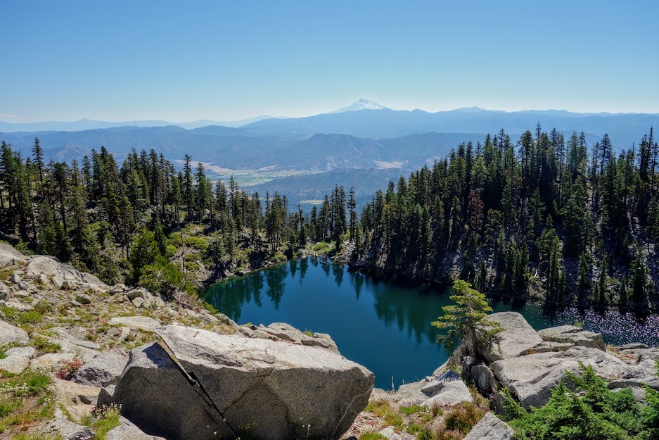
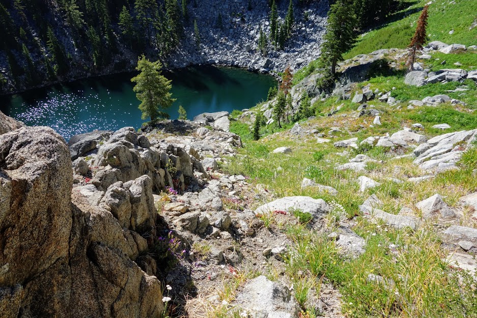
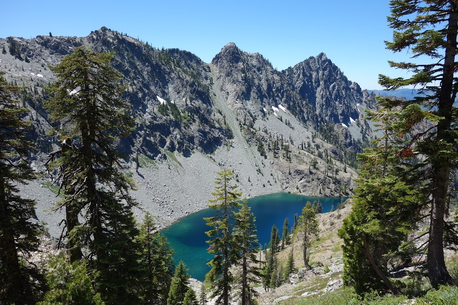
8. Man Eaten (aka Maneaten) Lake
I saved the best for last! Having been to this lake previously via other trailheads further north I knew this would be a great turnaround spot (blog link). I won’t lie it’s not a fun descent as it’s a combination of scree and steep loose dirt as you drop 500 feet in about 1/2 mile. This is the view from the PCT.
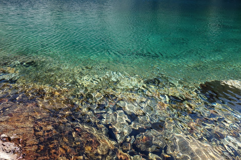
Finding turquoise-colored water in northern California is a rare treat. It is a deep lake with crystal clear water.
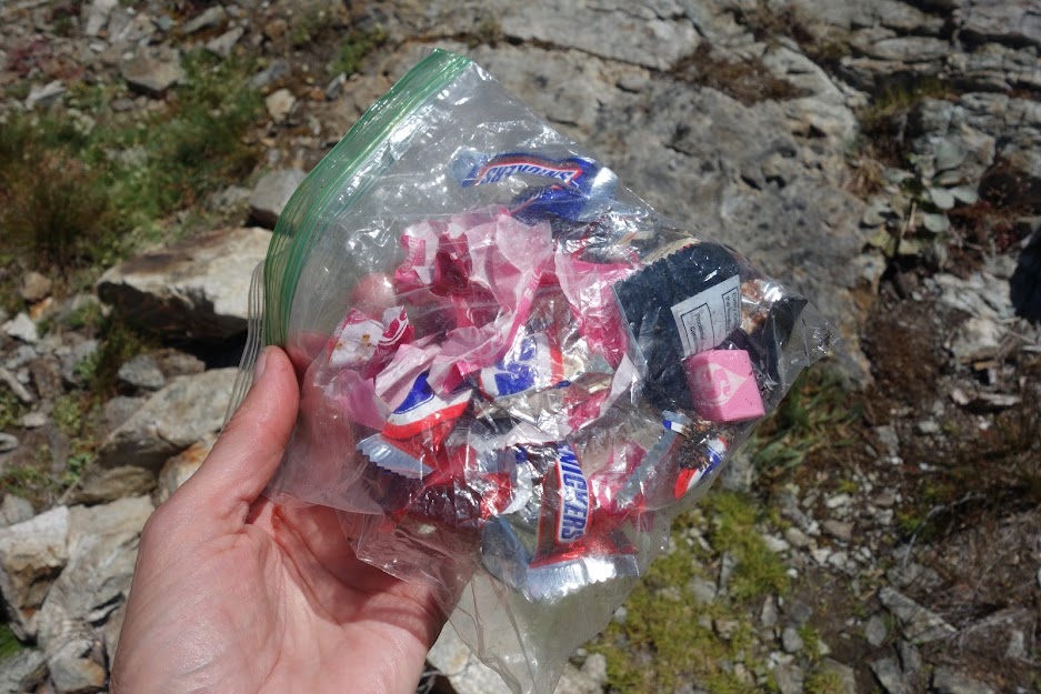
I met a group of 4 teenagers and a dad hiking out as I was arriving. They had caught several fish and sadly appeared to leave behind a bunch of trash. I was so glad I could collect before it ended up in the lake.
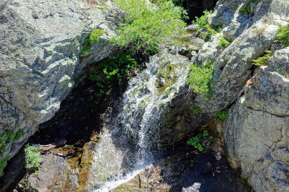
The lake outflow provided a nice waterfall.
I’d always wanted to camp at this lake so getting to witness sunset color was the perfect dessert for this trip.
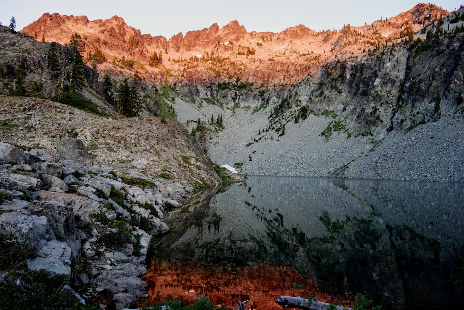
The next morning as I hiked out, I was gifted this reflection.

Lakes I didn’t visit:
Jackson Lake – this is a lake on private property.
Lipstick Lake – I visited this one from the Ducks Lakes side a few years ago so wasn’t interested in a Take 2. That trip made a lasting impression, in a very negative way (blog link).
Taylor Lake – there is a steep use trail from the PCT down to to the lake but this one is much better reached from the direct trailhead.
Adventure Date(s):
- July 8-14, 2020
Hike Details:
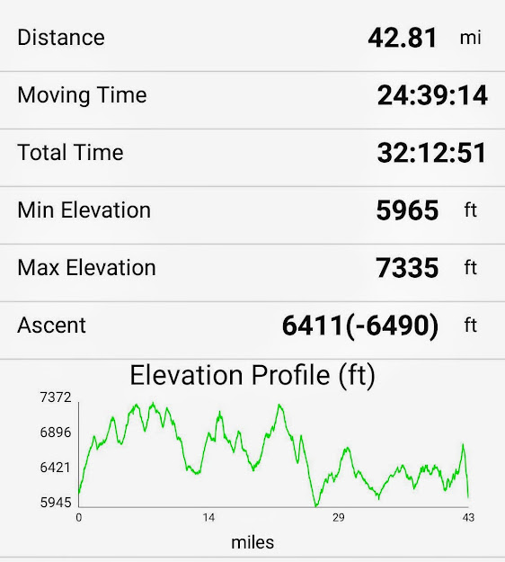
This is my one-way track from Carter Summit to Man Eaten Lake. It includes the lakes I visited as I hiked north but not the ones from the southbound trip. I’d say it’d be fair it was around 85 miles with 13,000 feet of elevation gain and loss.
Tips:
- Order your map in advance or call the ranger station to see if they have available.
- Obtain your California campfire permit online in advance (it’s required for your backpacking stove).
- Mileage in Art’s book were quite different than those I obtained from my Gaia track and noted above.
- Guthook/Atlas app is great for viewing current water conditions.
Resources:
- USFS – Russian Wilderness
- USFS – Klamath National Forest, Marble Mountain Wilderness
- USFS – Marble Mountain Trails
- USFS – Marble Mountain Trail Conditions
- Map – USFS, Marble Mountain and Russian Wildernesses
- Book – Best Hikes of the Marble Mountain and Russian Wilderness Areas, California by Art Bernstein
Links:
I participate in the Amazon affiliate program and may receive a commission on qualifying purchases linked in this post. It doesn’t affect your price but it helps support this site.

Pingback: CA – Russian/Marble Mountain Wildernesses, a PCT Wildflower Jaunt – Jan's Jaunts and Jabberings
Pingback: CA – Russian/Marble Mountain Wildernesses, PCT Eye Candy – Jan's Jaunts and Jabberings