Peterborough is a community of approximately 6,200 permanent residents located in the south western corner of New Hampshire. Like many New England towns, Peterborough has a wealth of history and culture, including former mills and a thriving artisan community. Downtown Peterborough can be accessed from Grove Street, Summer Street, Union Street or Main Street and is the center of local business activity, home to the Town Hall, Town Library, Fire Station and other important town features.
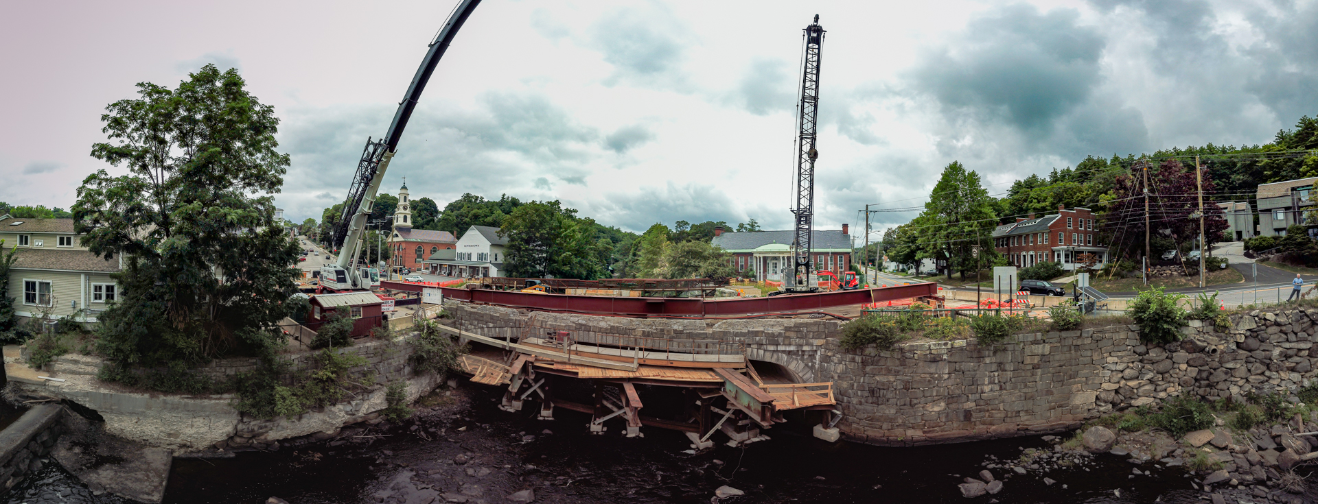
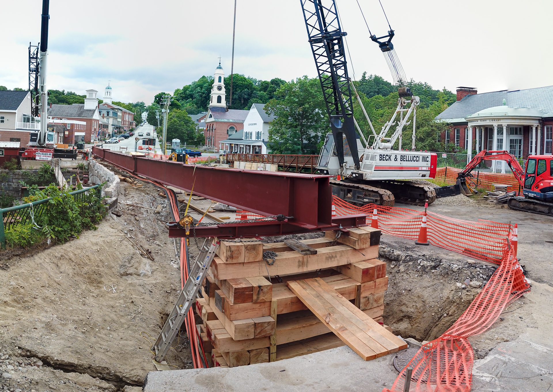
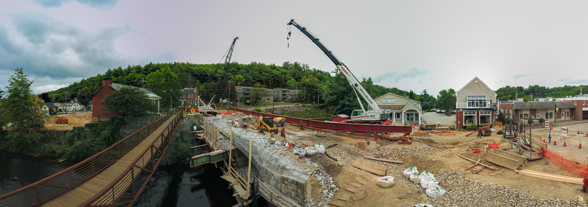
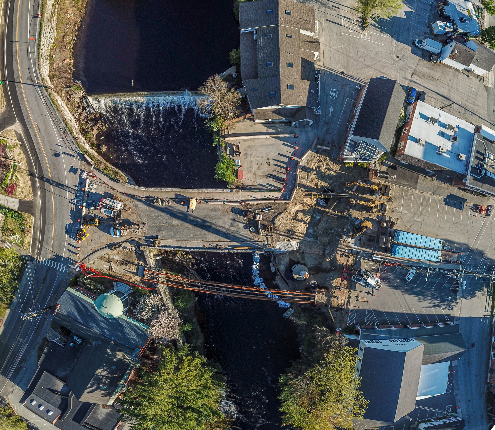
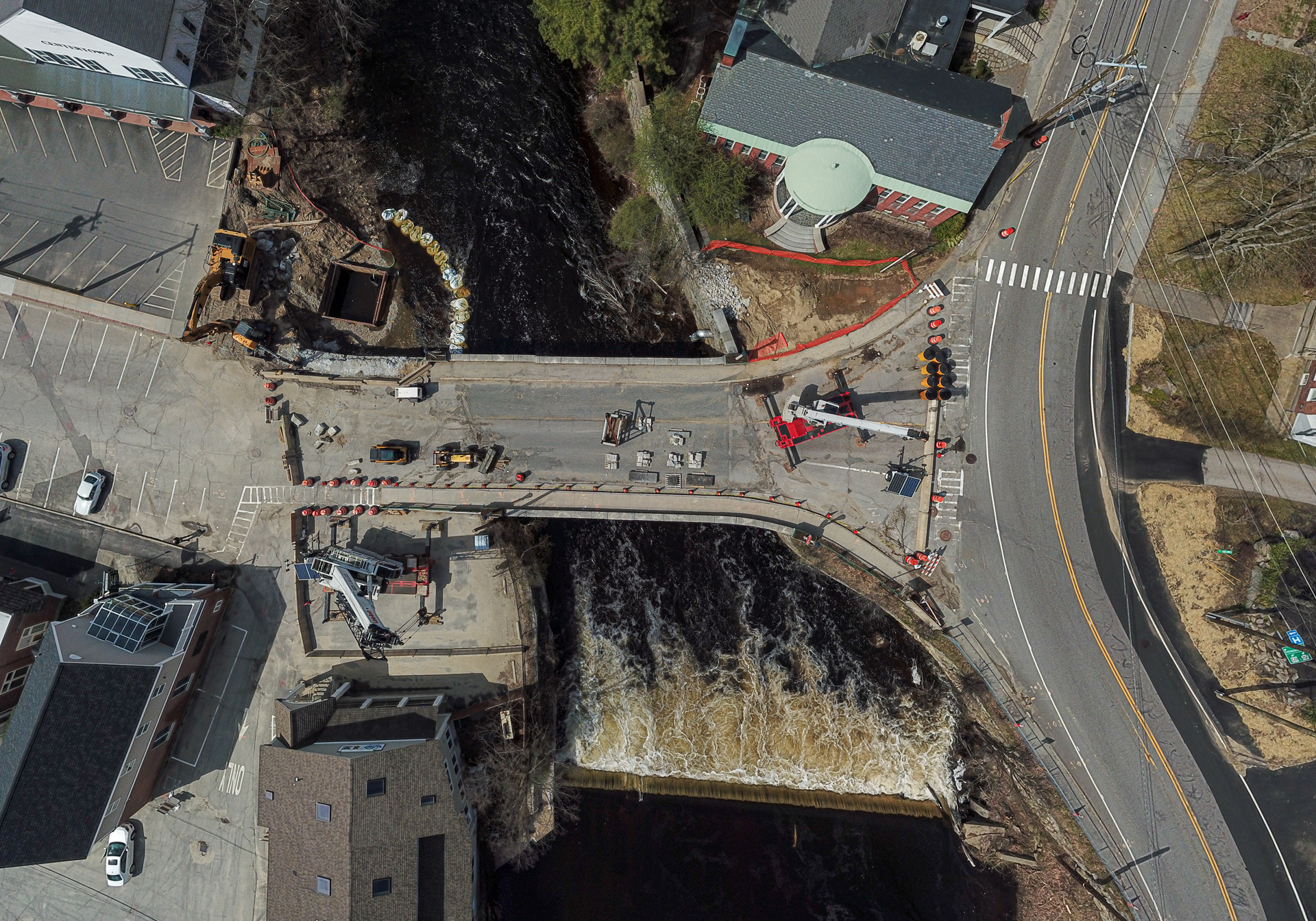
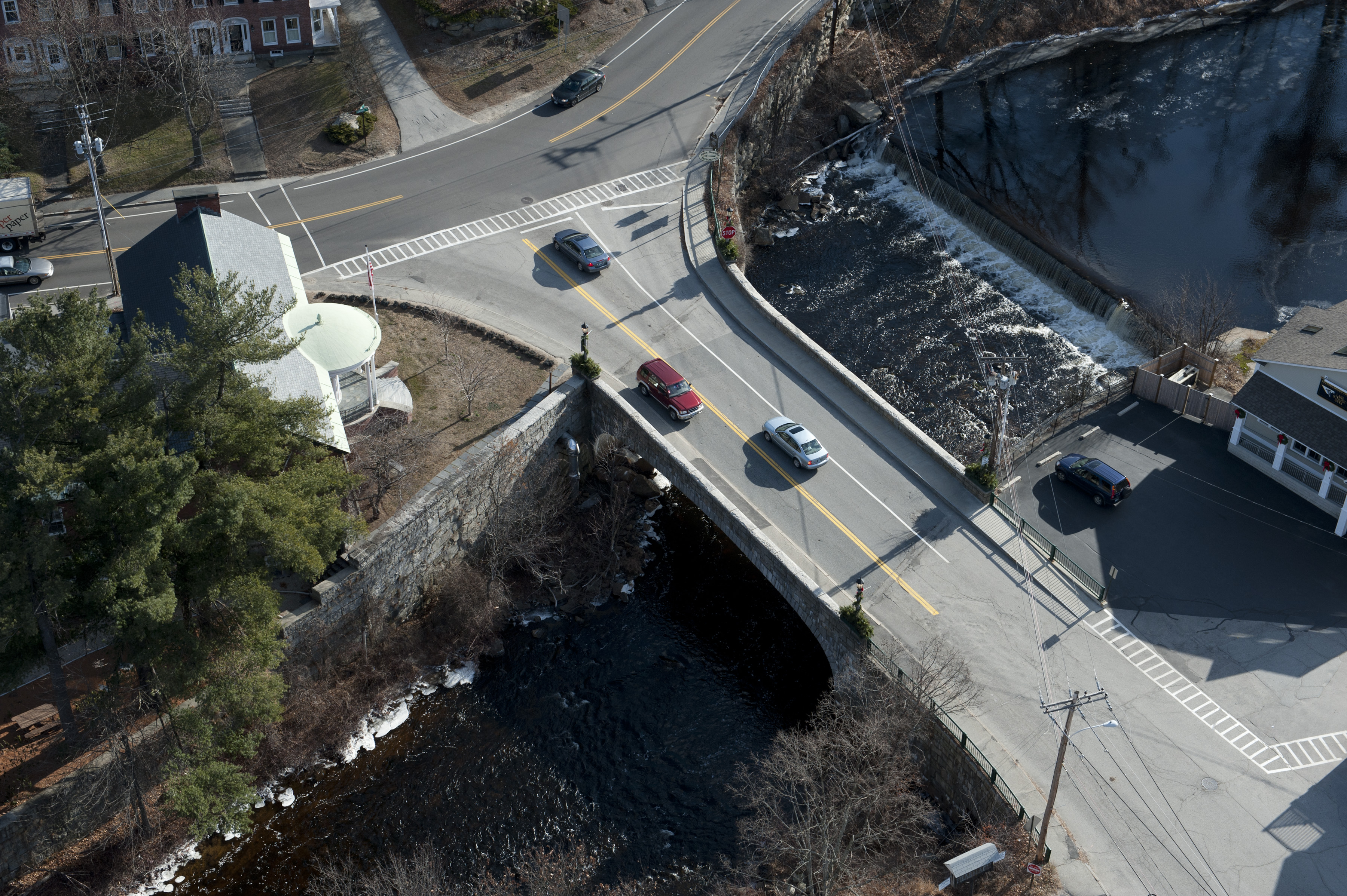
The Peterborough NH Main Street Bridge project is located in the area known as “downtown” Peterborough, also considered the “Gateway” to Peterborough. Main Street intersects US Route 202 at the eastern terminus of the Main Street bridge over the Contoocook River. US Route 202 is a Class I roadway that is oriented primarily north-south and connects to NH Route 101 approximately 0.6 miles south of the Main Street intersection and continues south to the Jaffrey town center and to Massachusetts. North of the intersection with Main Street, US Route 202 continues to the Antrim town center and to Interstate 89 in Contoocook. NH Route 123 and US Route 202 overlap within the project area. Locally, US Route 202 is known as Pine Street and Granite Street south of the Main Street intersection, and Concord Street north of the Main Street intersection. The project limits include approximately 400’ of Main Street (200’ to the west and 125’ to the east of the bridge), 1,500’ of US Route 202 (500’ north and 1000’ south of the intersection including the Pine Street/US Route 202 intersection), and the area immediately downstream of Transcript Dam within the Contoocook River.
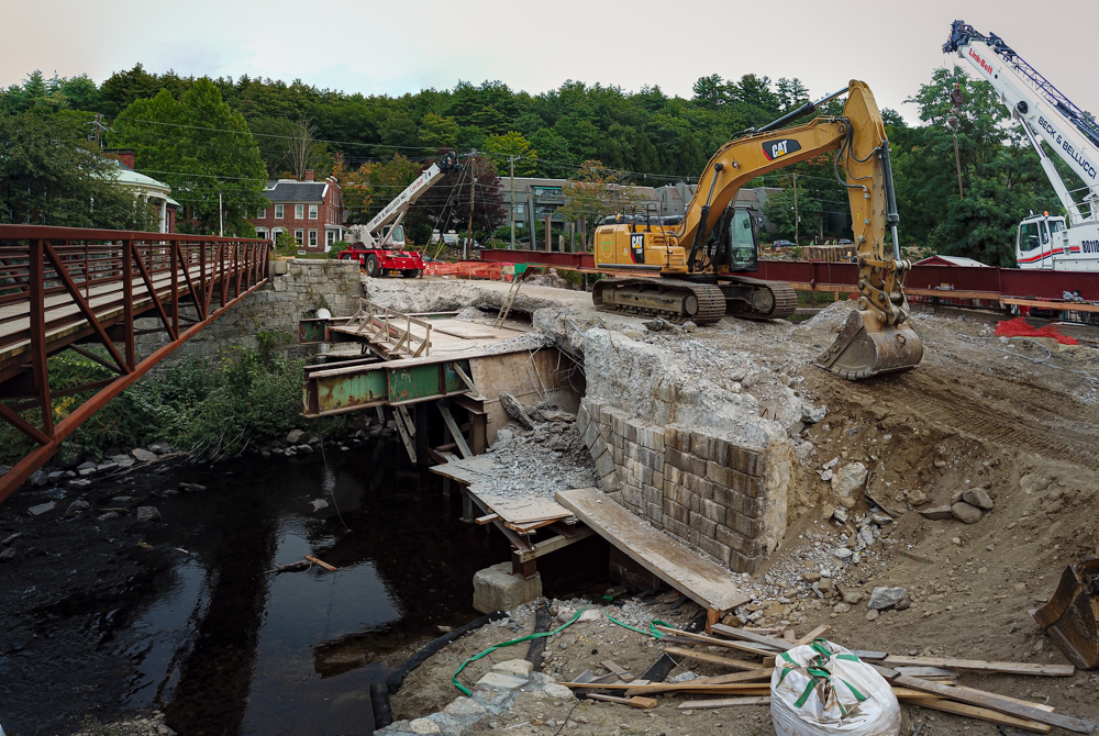
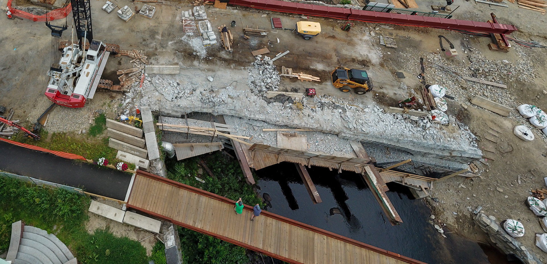
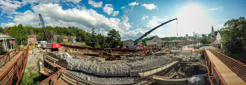
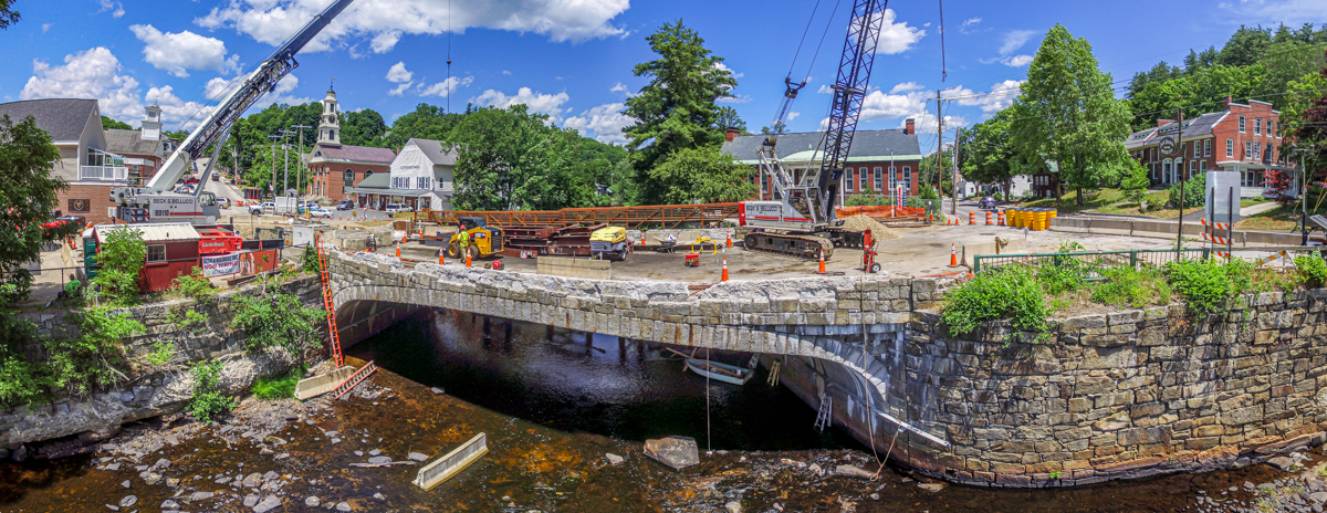
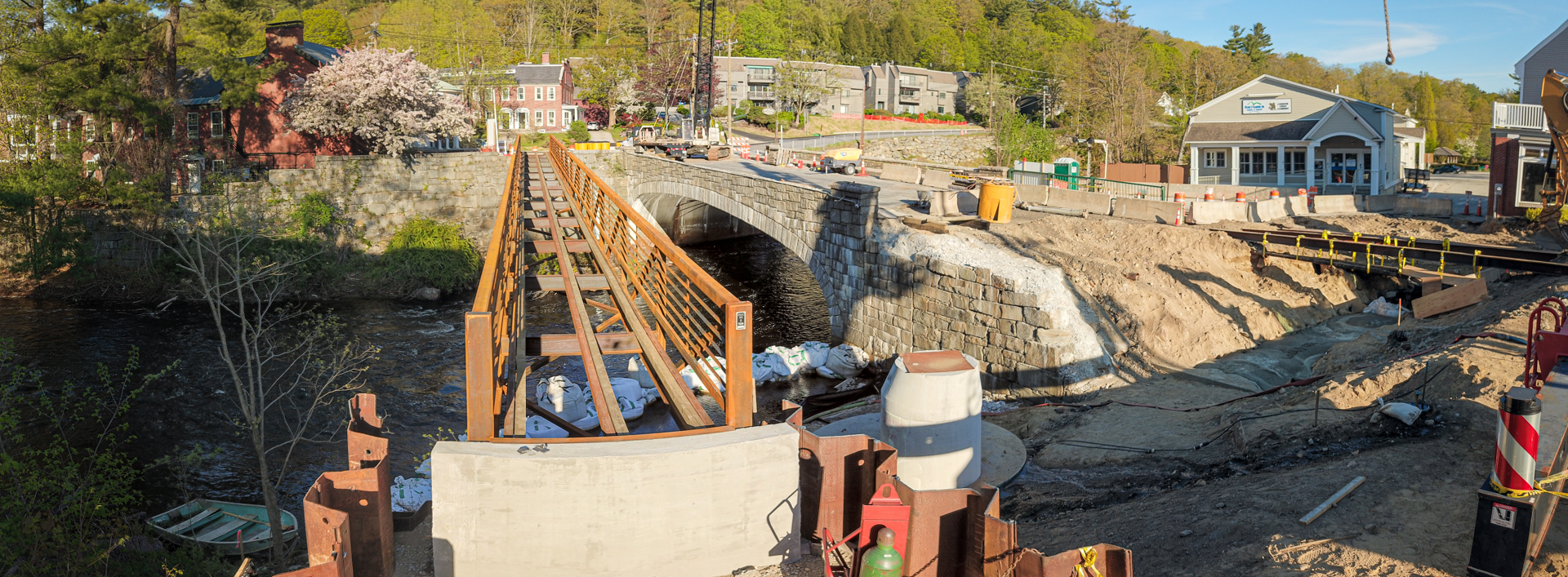
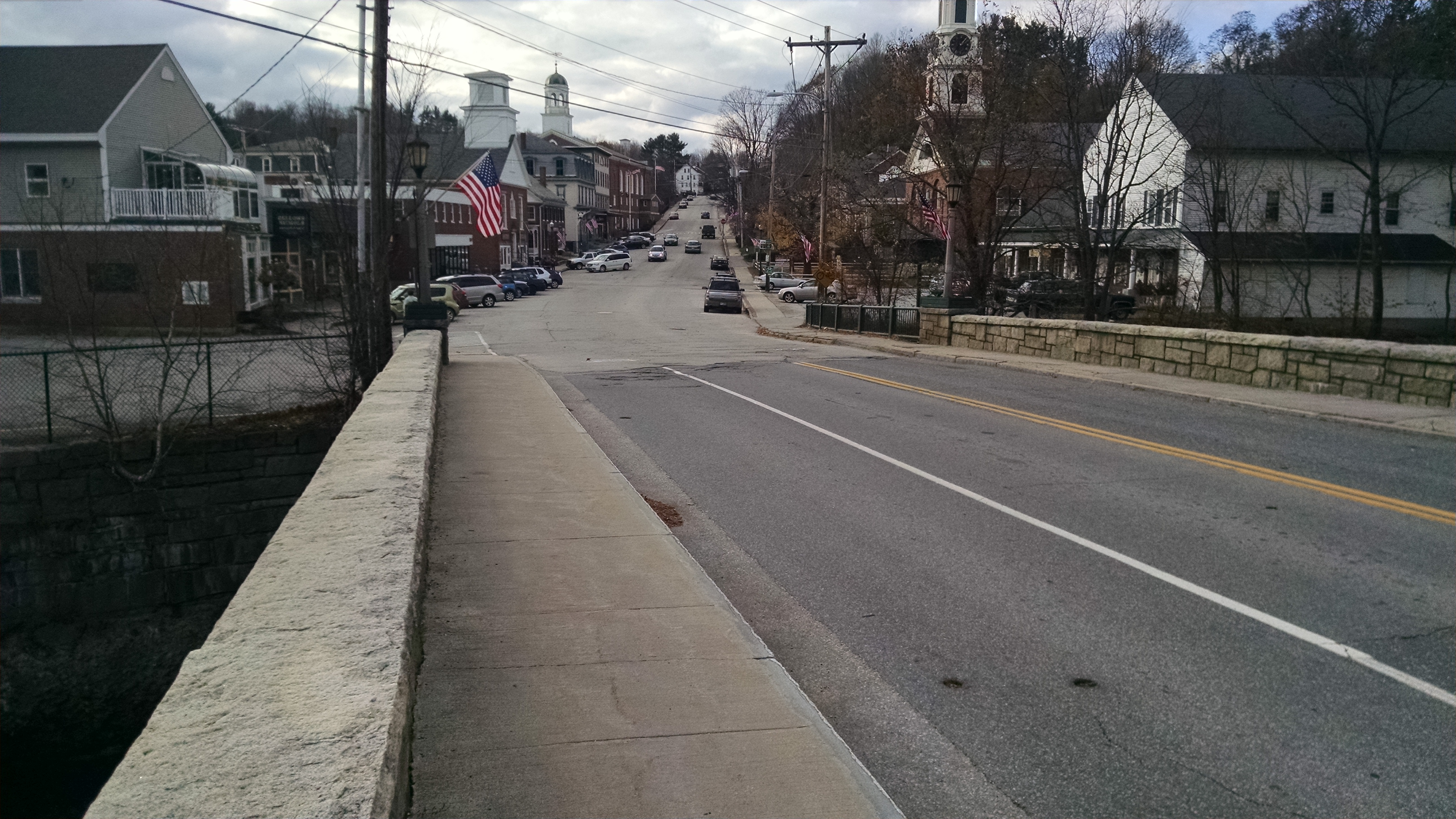
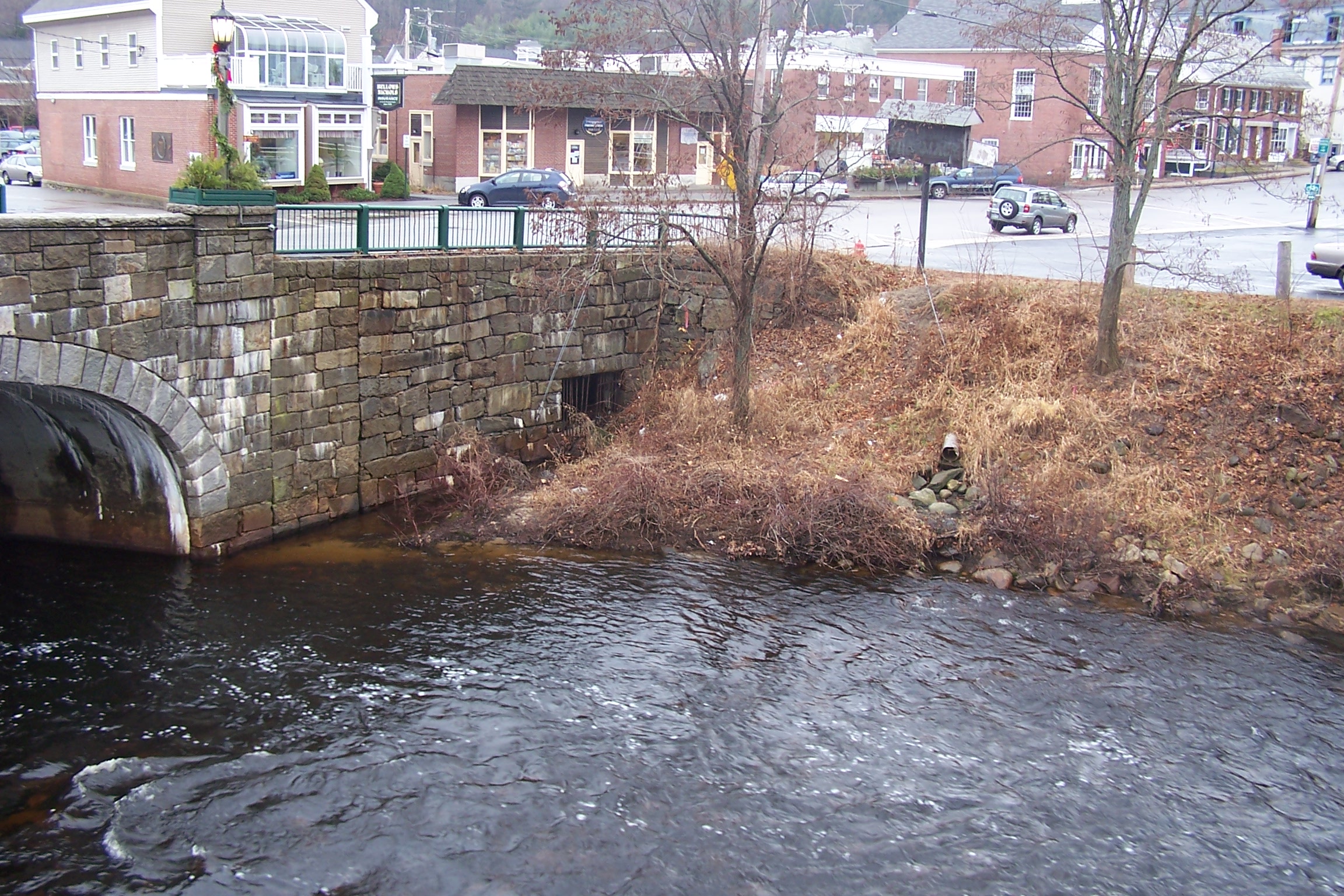
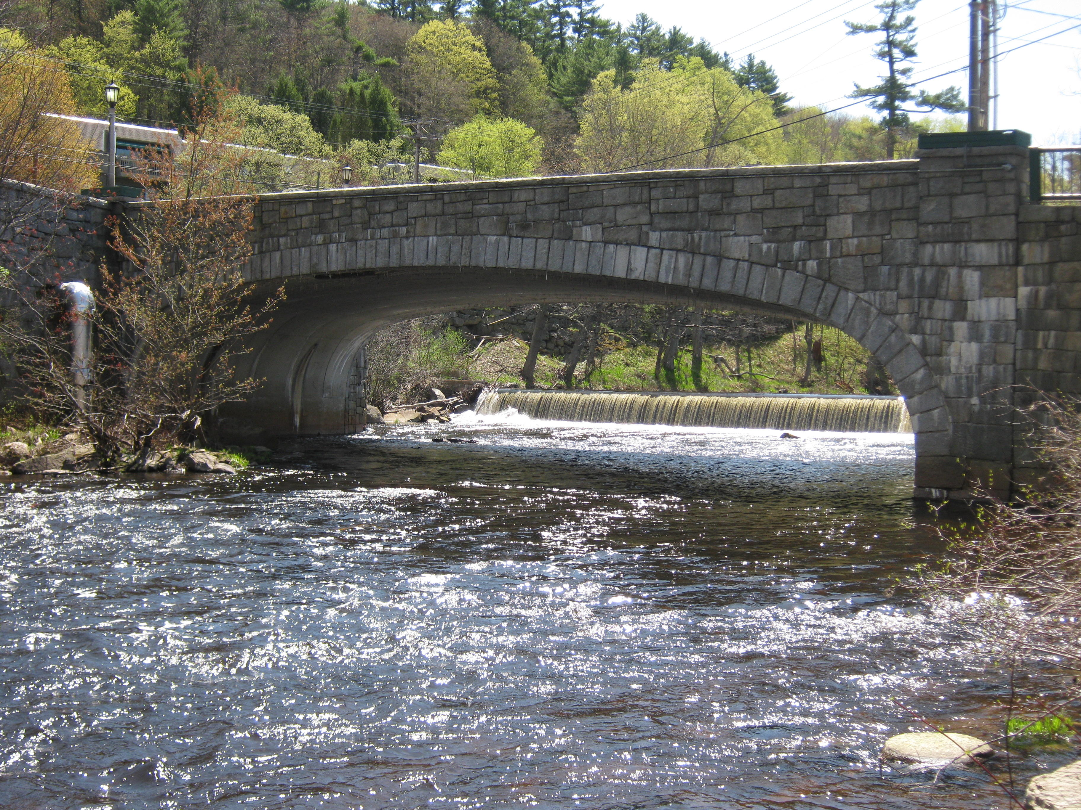
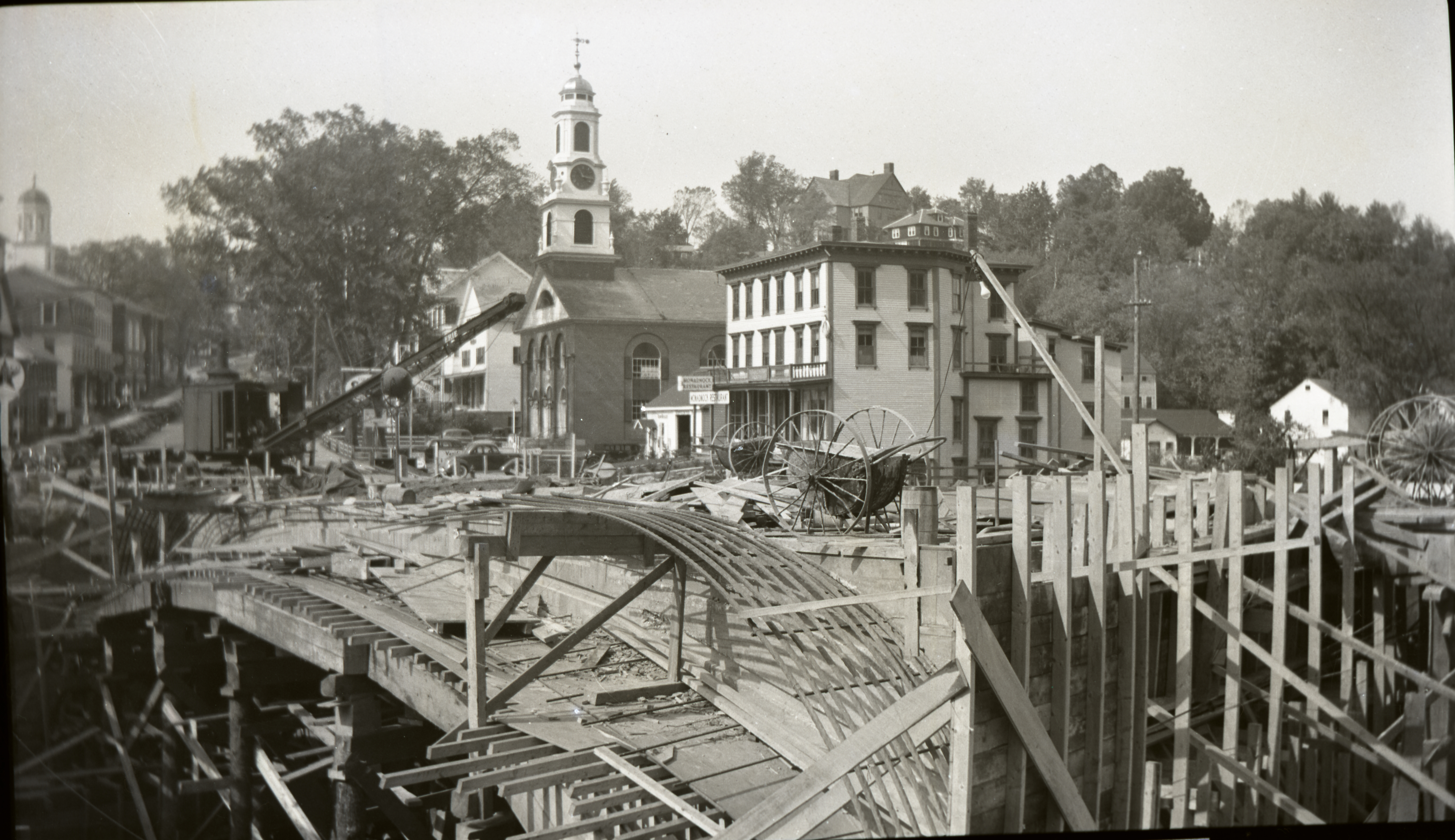
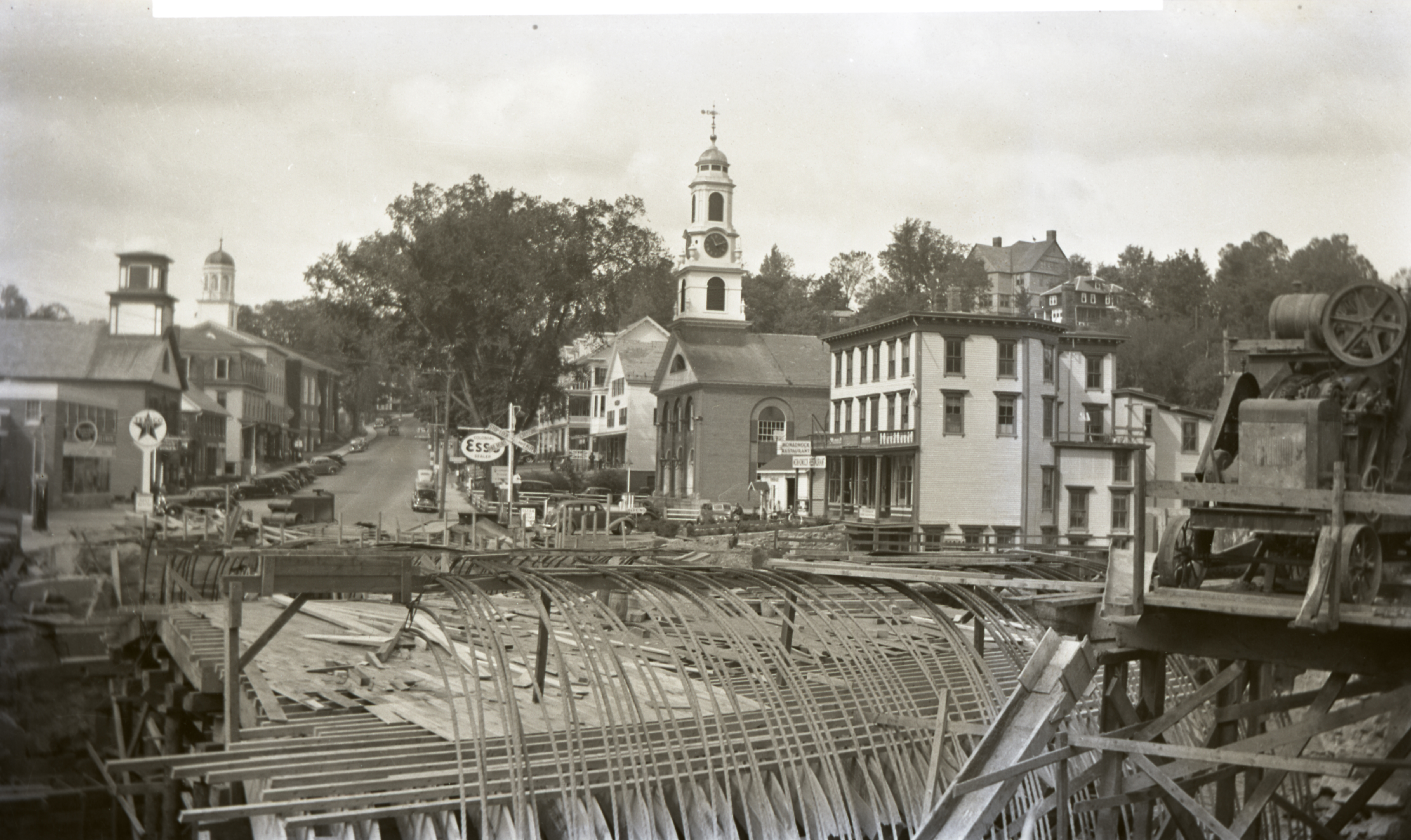
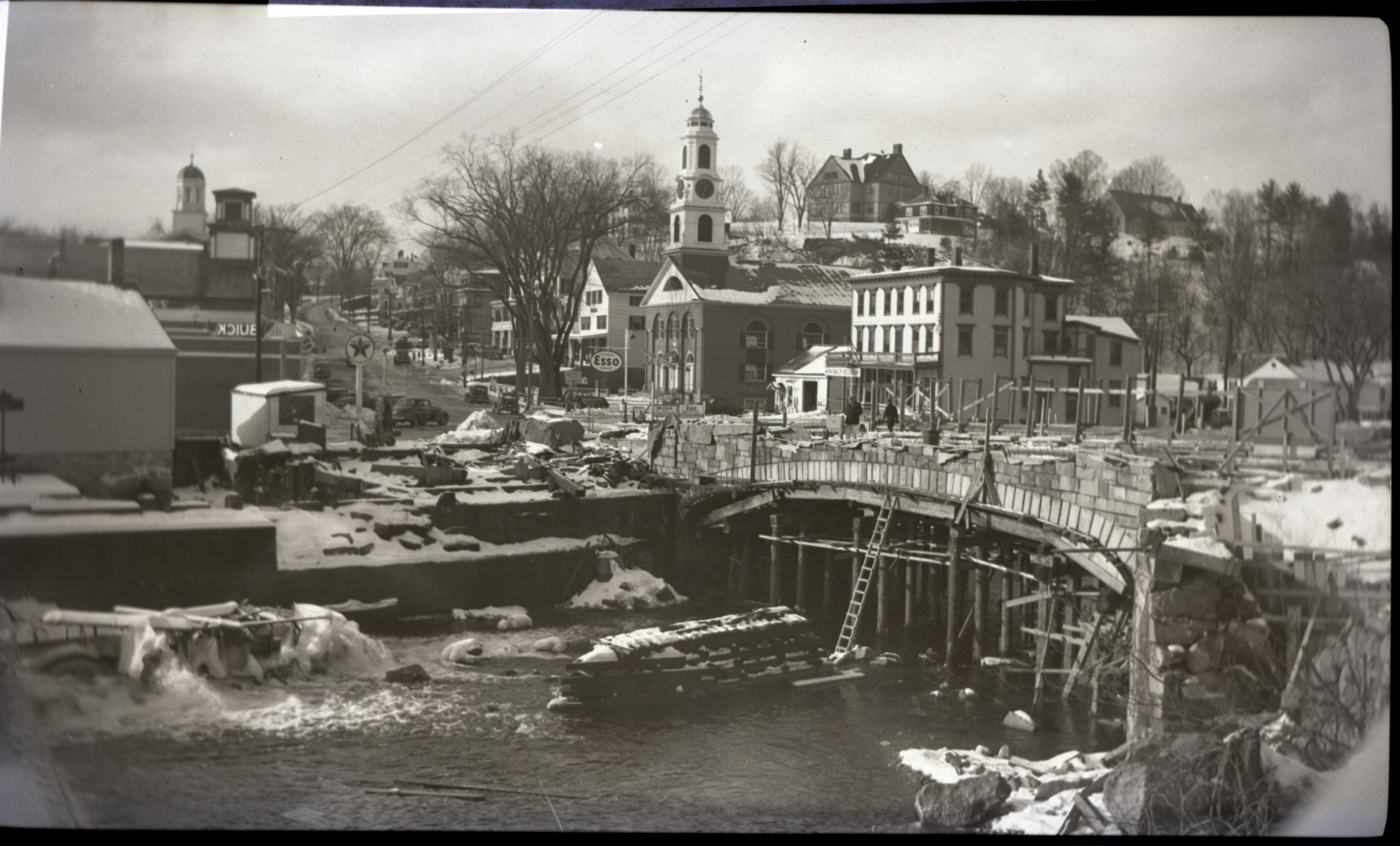
The Main Street Bridge (No. 092/089) is a 75-foot clear-span cast-in-place concrete rigid frame with a 30’-0” curb-to-curb width and 5’-0” wide sidewalks on each side of the bridge. The structure is adorned with stone-faced concrete parapet railings along each sidewalk, stone facing on both fasciae, and ornamental lighting at each corner. Main Street is oriented primarily west to east over the Contoocook River. This bridge was originally constructed in 1940 to replace a former two-span stone arch bridge lost to flooding during the hurricane of 1938.
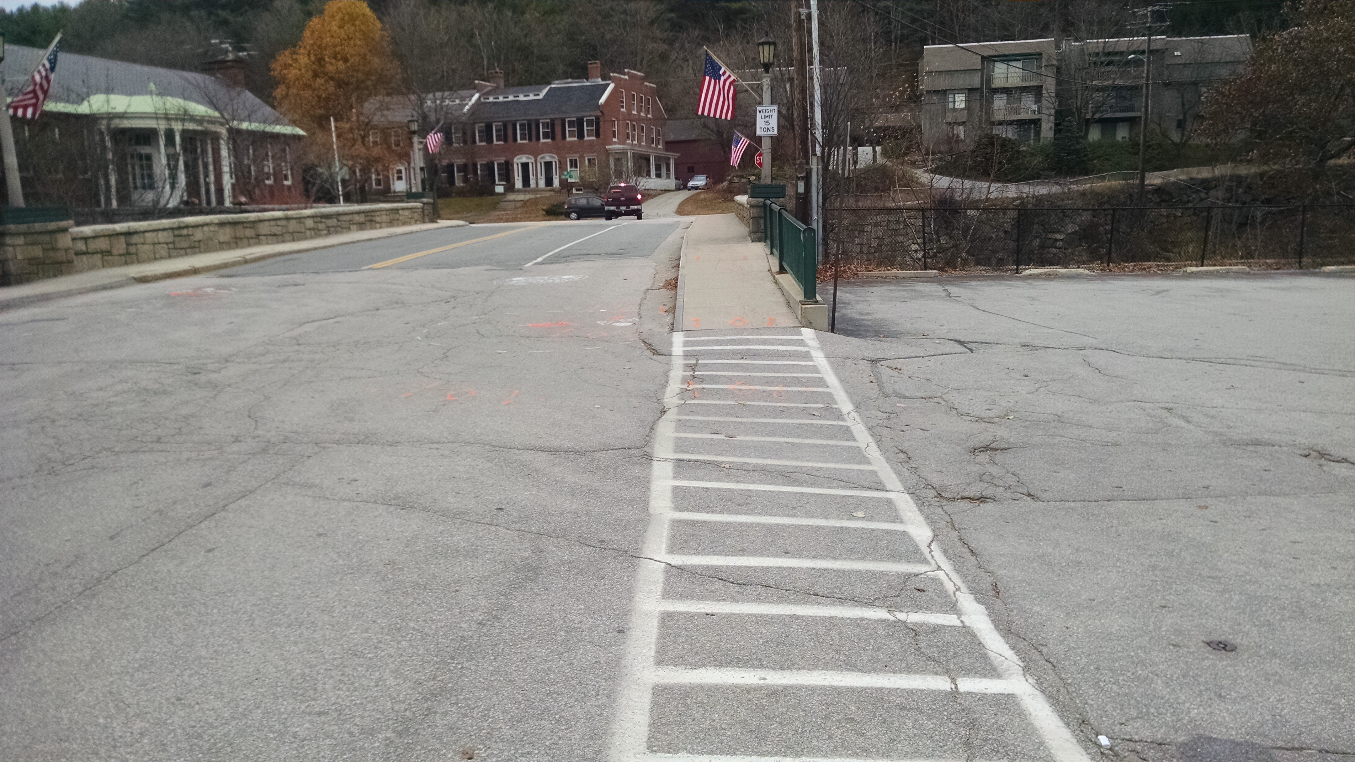
Due to the deteriorated condition and the structural analysis results, the structure was downposted to a weight limit of “15 Tons” in 2009 by order of the Town of Peterborough Selectboard.
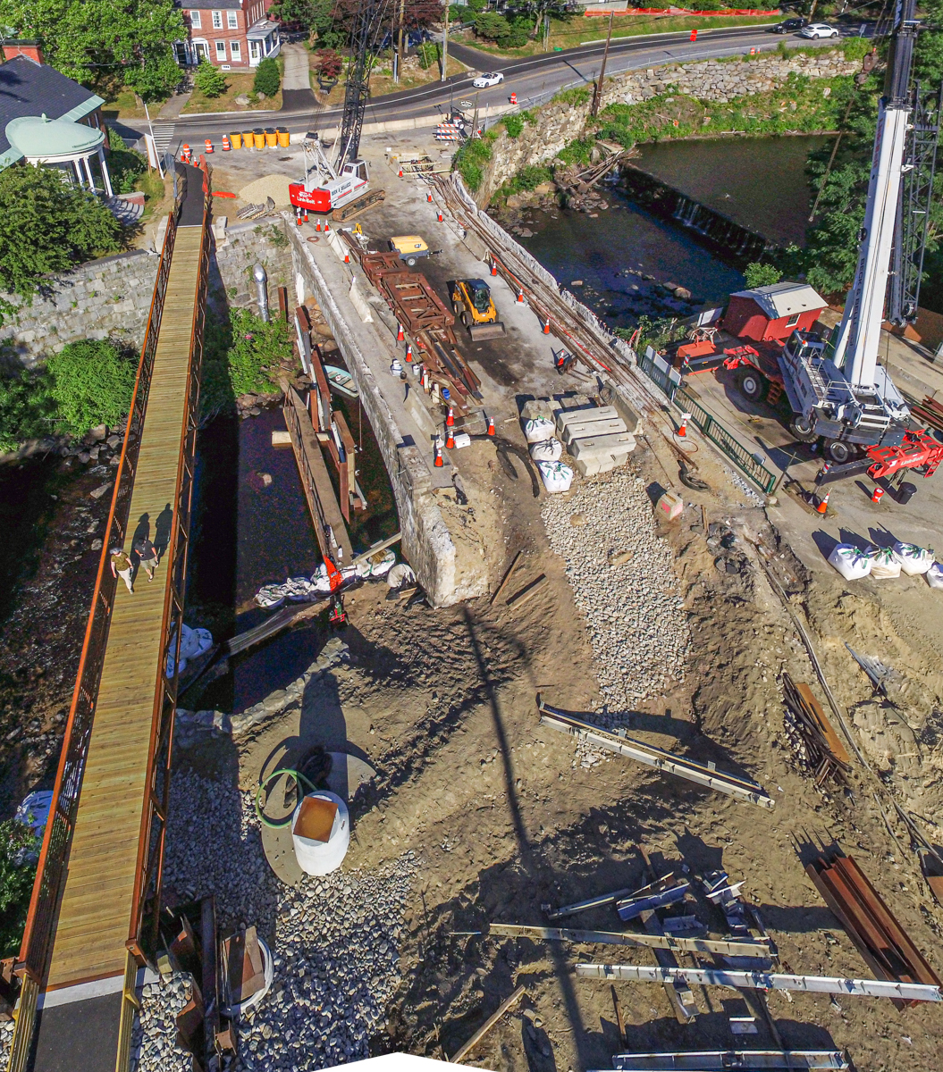
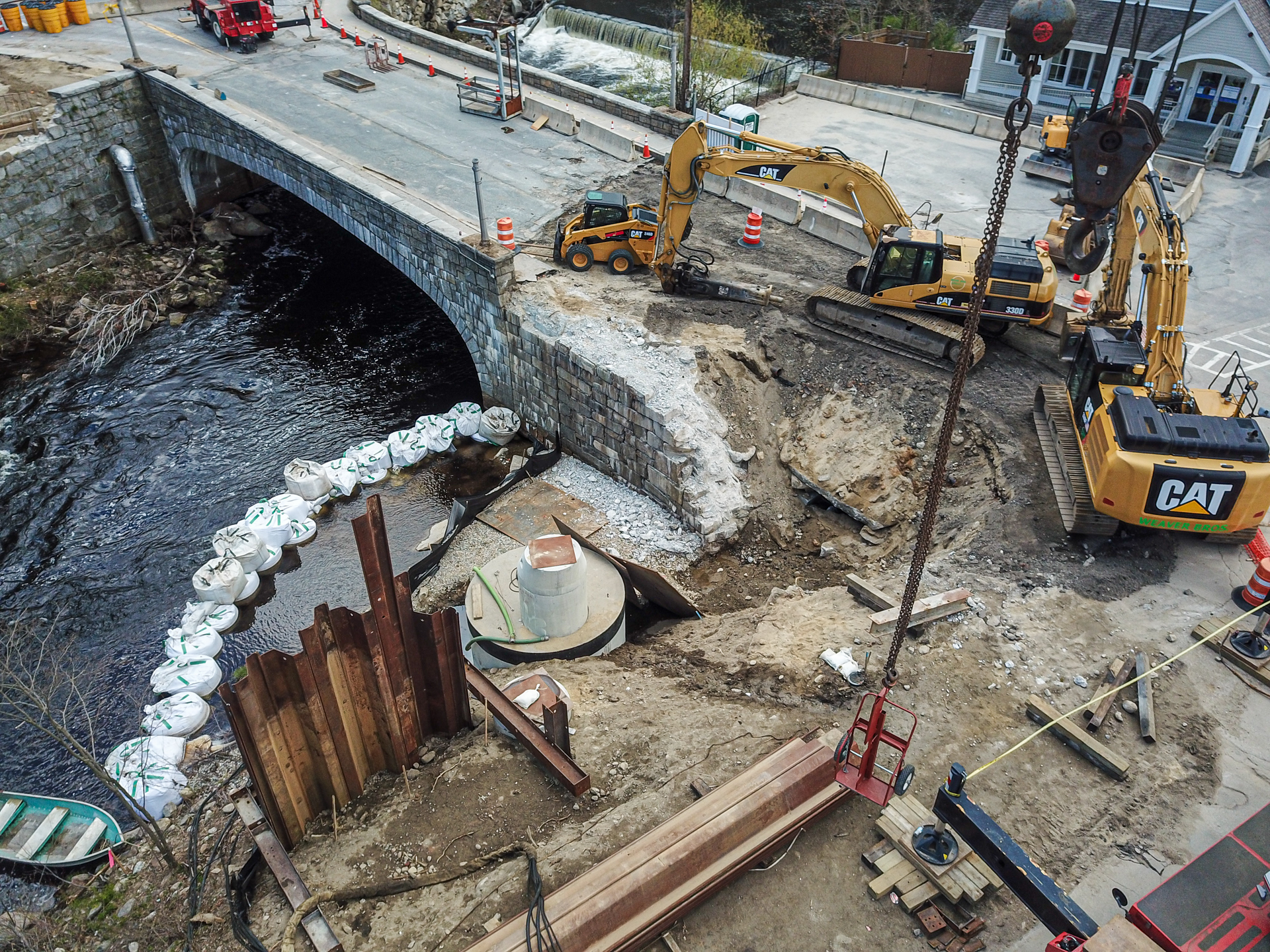
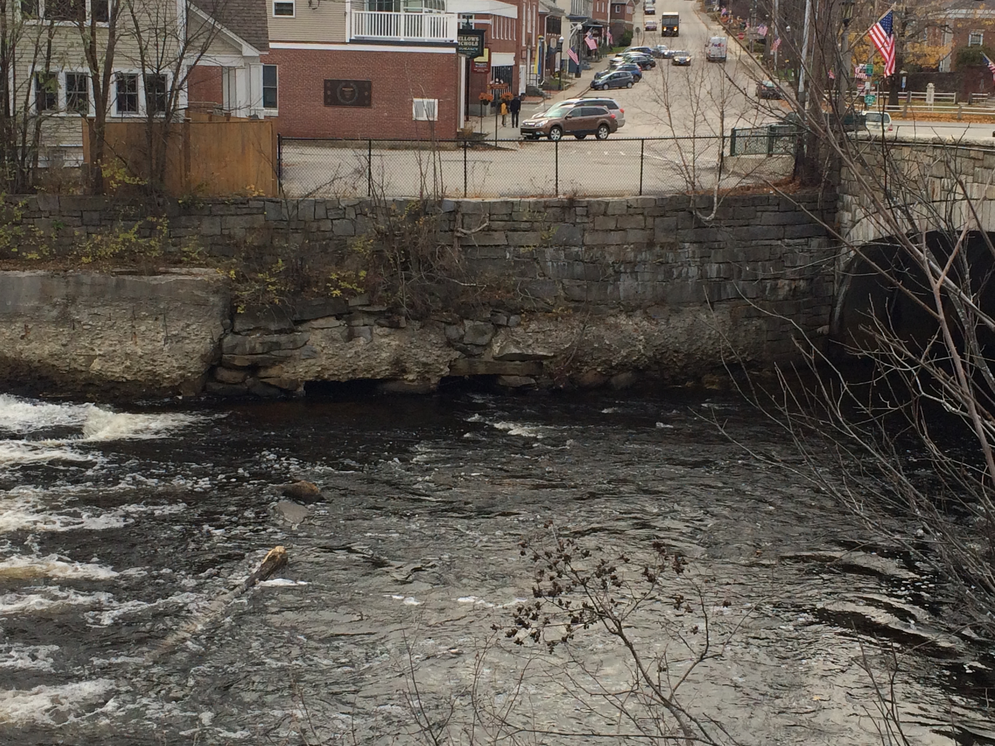
The outlet of an existing drainage canal is located in the northwest wingwall of the bridge. This canal was originally constructed as a mill race to service the downtown area, but over the years has been modified from its original configuration to meet the changing needs of the downtown area, and to address deficiencies in the condition of the structure. The canal now serves as a component of the stormwater outfall system for the downtown area, and the known portions consist of approximately 450’ of underground structure.
The canal extends southerly from the outlet under Main Street and then under the commercial structure located at 10 Main Street (Bellows-Nichols Insurance). The section of the canal within the project limits is approximately 8’ to 10’ wide and 7’ high, and is constructed of granite roof slabs supported by stone masonry walls constructed of a mix of mortared stone, masonry, and dry stone masonry. The size and construction of the canal varies substantially throughout its length, and much of the original canal has been replaced with drainage piping or new concrete roofs and walls. The section of the canal under Main Street, at the west side of the bridge, is in poor condition. In June, 2011, a section of granite slab canal roof failed and caused a sinkhole to form in the Main Street roadway, just west of the Main Street Bridge. Improvements to the canal are necessary in this area to prevent future failures of this nature. Reconstruction of the northwest wingwall of the bridge will impact the northerly section of the canal.
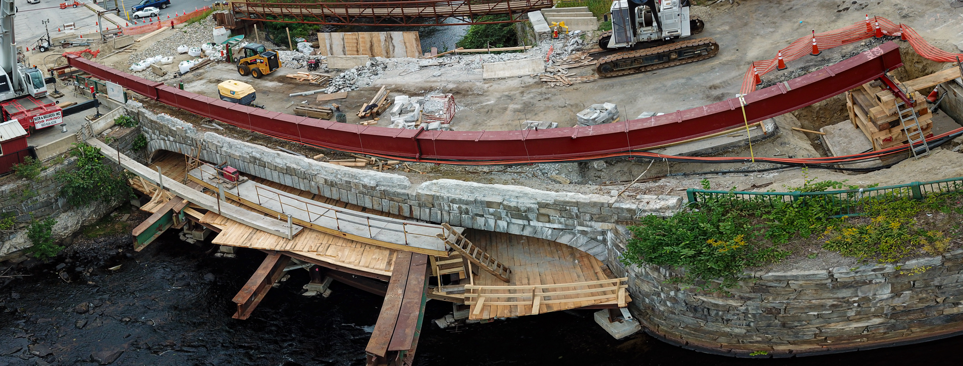
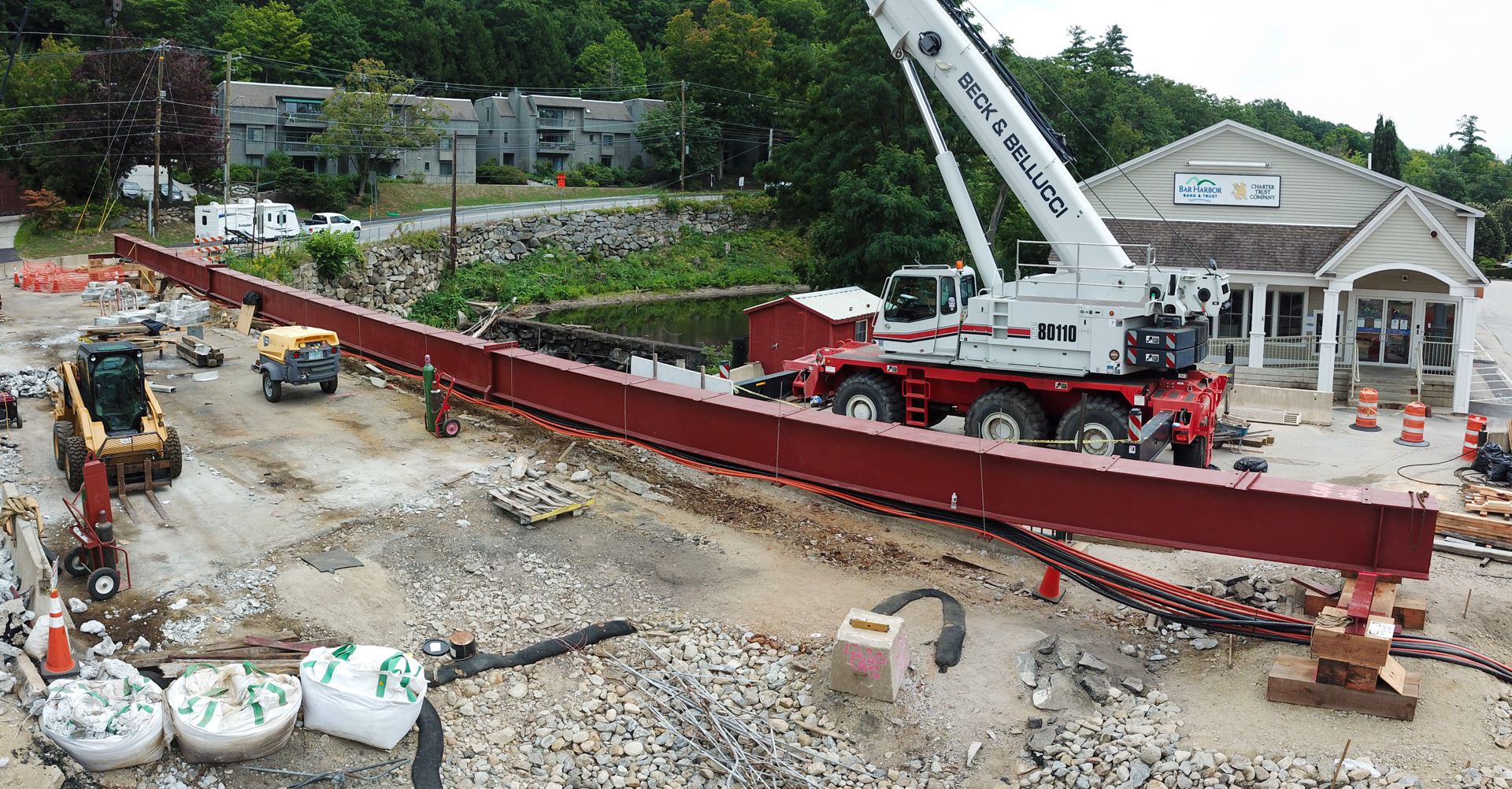
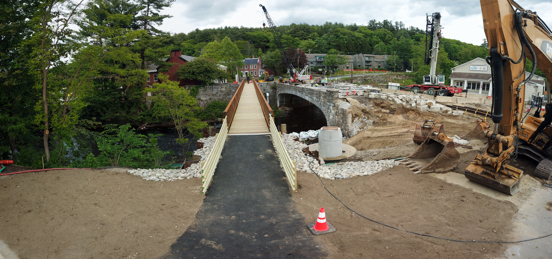
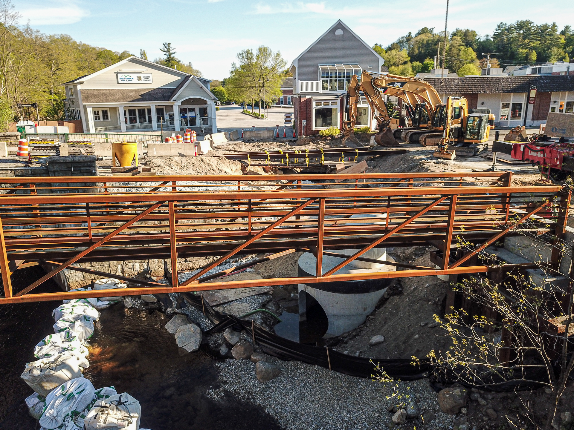
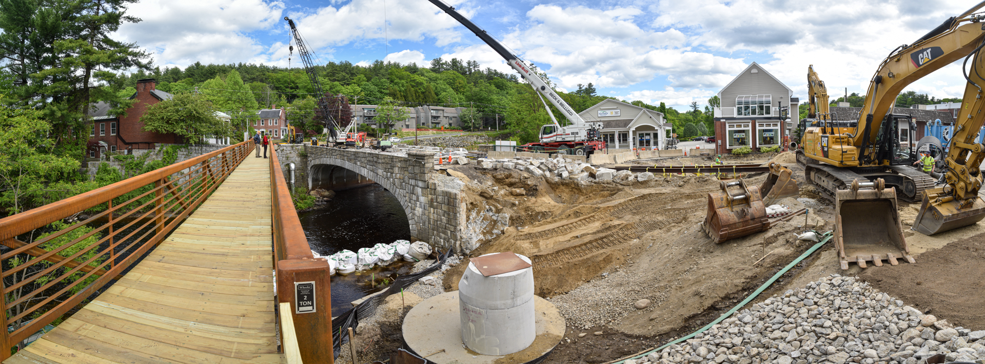
The existing Main Street Bridge will be completely replaced with a cast-in-place concrete rigid frame bridge on spread cast-in-place concrete footings. The replacement bridge will be wider measuring 47’ -7” in width to allow for the widening of the travel lanes, necessary for improved vehicle movement and safety over the bridge and through the Main Street/US Route 202 intersection, while providing two sidewalks on the bridge. The existing lane widths of 10’, 10’ and 10’ will be replaced with widths of 12’, 11’, and 10’ from the north side of the bridge to the south. The replacement bridge will match the aesthetics of the existing bridge to the extent practicable, including the span length and general geometric proportions, railing type, and footing elevations. The existing squared stone masonry facing will be removed from the bridge, stored and reinstalled on the new bridge to recreate the appearance of the existing structure. Vibration monitoring will occur within adjacent buildings, including the Peterborough Town Library and Brick Block building, as a protective measure during construction.
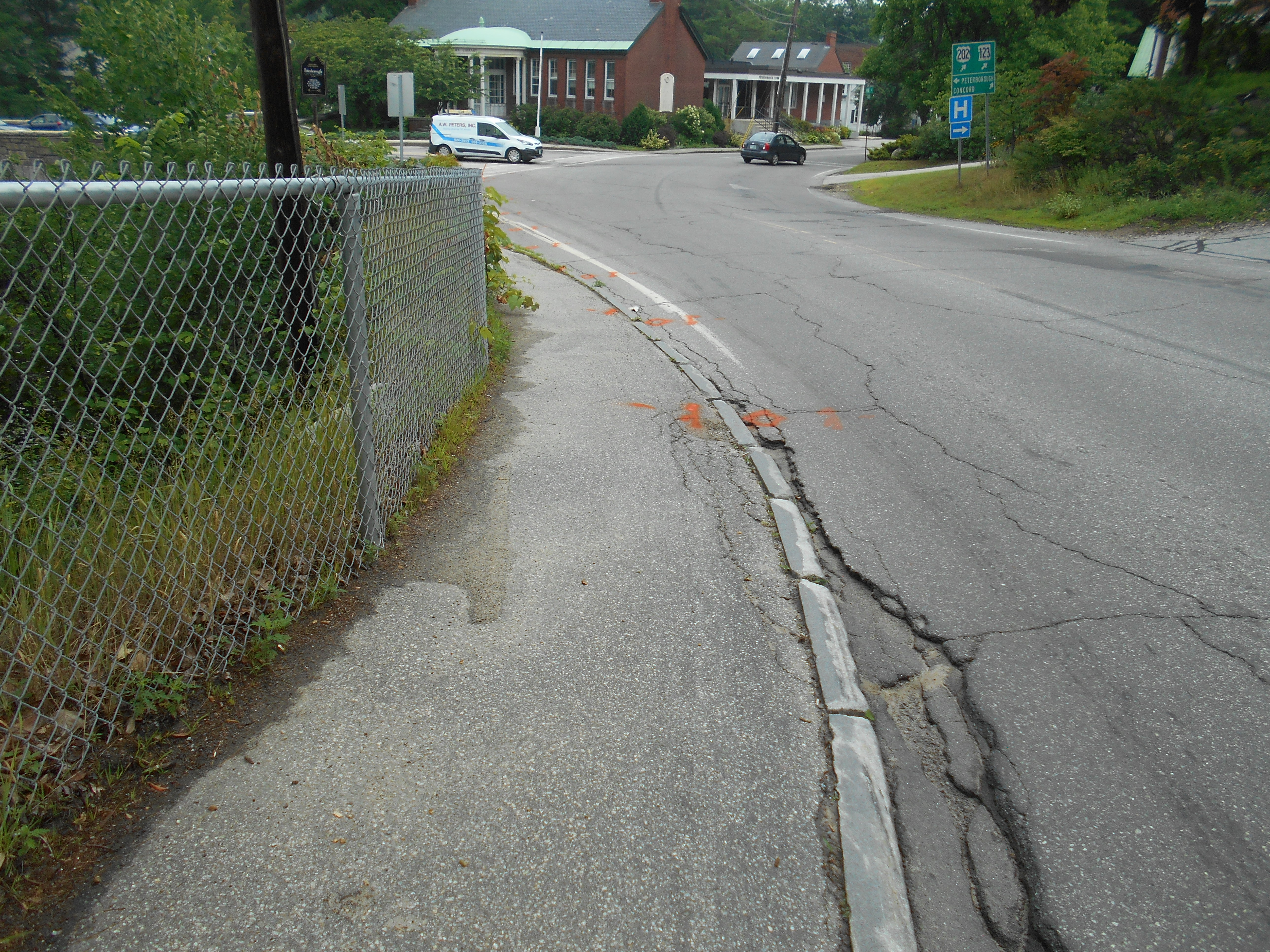
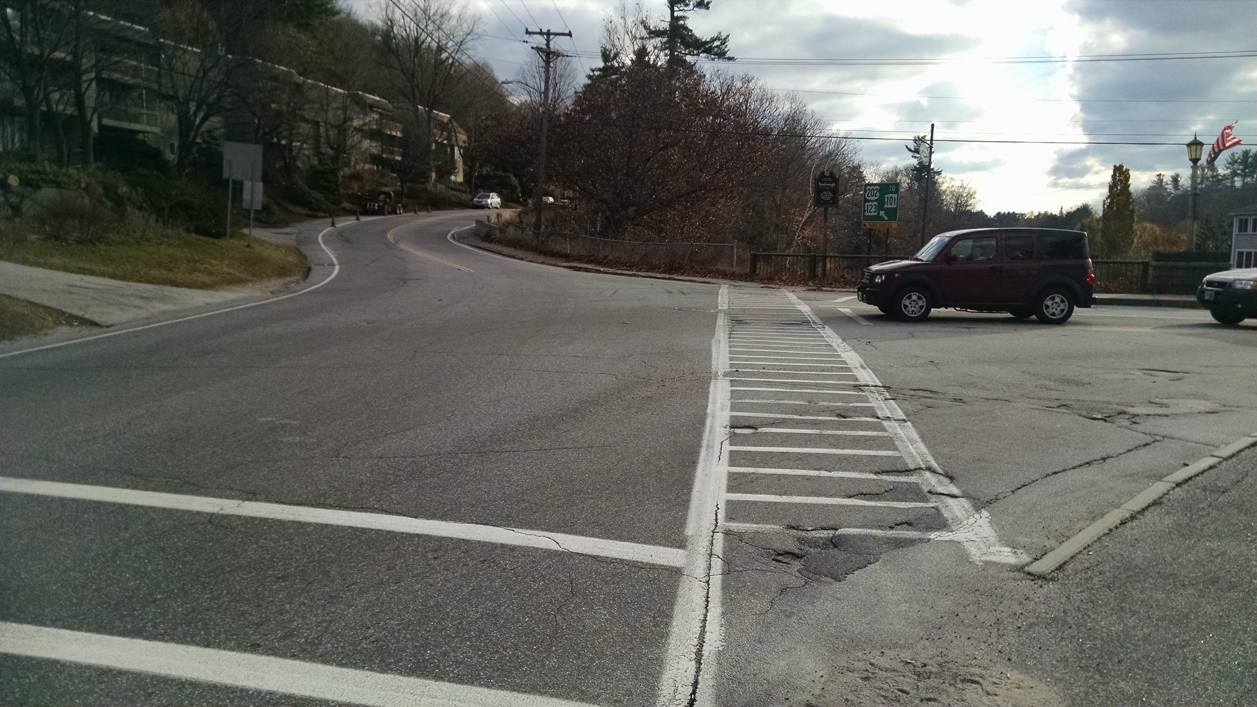
The Main Street/US Route 202 intersection functions at Level of Service (LOS) of F and presents safety issues for pedestrians, bicyclists and motorized traffic. Levels of Service range from A, best, to F, worst. This unsignalized three-way intersection has stop control only on the Main Street eastbound approach. The US Route 202 northbound and southbound approaches have free movement through the intersection. Main Street approaching the intersection consists of a single eastbound lane which splits into separate right and left turn lanes of approximately 140’ length from the intersection. A single westbound lane exists for traffic entering Main Street from US Route 202.
There are currently sidewalks on the westerly side of US Route 202 throughout the project limits. On the easterly side of US Route 202, a sidewalk exists only north of the intersection with Main Street. Two crosswalks exist within the project limits – one crossing US Route 202 at the intersection of Pine Street and US Route 202, and one crossing Main Street at the easterly end of the bridge.
The intersection of Main Street and US Route 202 will be reconstructed with its existing “T” configuration and volume capacity remaining unchanged. The proposed horizontal alignment of US Route 202 will closely match the existing to the north of Main Street, but will be revised by shifting the proposed centerline to the west immediately south of Main Street and matching back into existing approximately 450’ south of the intersection. Although the overall pavement width on US Route 202 will not be substantially widened, the revised alignment will allow for an improved and safer condition for pedestrians, bicyclists and vehicles. The vertical alignment of US Route 202 will remain largely unchanged by the project, with the design intent of matching the proposed profile to the existing. Shoulders along US Route 202 will be widened to a typical width of 5’ within the projects limits, with most of the shoulder modifications required to the south of Main Street and extending to the southerly project limits.
In addition to the improvements listed above, because vehicular traffic on US Route 202 is uncontrolled at the Main Street and Pine Street intersections, the Town of Peterborough has requested that pedestrian crossing aids be incorporated into the project. Per NHDOT recommendation, Rectangular Rapid Flashing Beacons (RRFB) will be installed at both of these locations. Rectangular Rapid Flashing Beacons are rectangular amber LED’s mounted below pedestrian crossing warning signs at the crosswalk that use an irregular flash pattern to increase driver recognition of pedestrians crossing and increase yielding behavior. RRFBs are typically push button activated and solar powered.
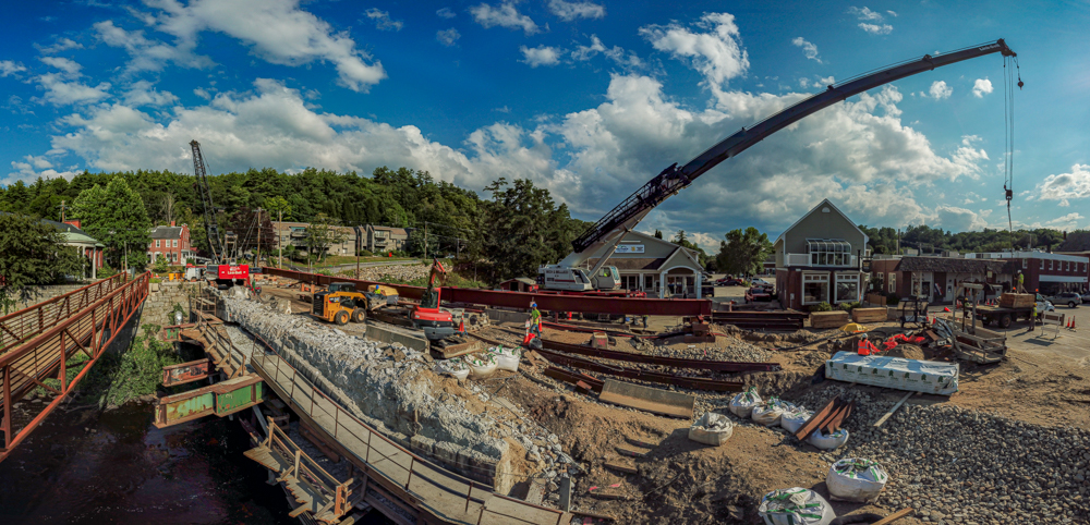
The existing retaining wall along the east side of the river adjacent to US Route 202, upstream of the Main Street Bridge, is comprised of three distinct sections of differing construction. Beginning at the easterly rigid frame leg of the bridge and heading south, the wall types are as follows: a mortar rubble masonry wall constructed with the bridge for a length of approximately 50’, a stacked stone boulder retaining wall for a length of approximately 375’, and a cast-in-place concrete wall for a length of about 185’ to the southerly project limits.
The stacked boulder portion of the retaining wall is in poor condition as indicated by the reported sinkholes that occur on US Route 202, and documented settlement and translation. It is believed that the stacked boulder segment of the retaining wall dates back to the 1890s. This segment of the retaining wall was evaluated in 2001 and found to have deficiencies and require strengthening measures to maintain long-term performance. Due to the condition of this segment of the wall, it has been the subject of inspections, evaluations and studies since the late 1990s. Movement and settlement of the wall have precipitated periodic pavement shimming on US Route 202 resulting in pavement thicknesses approaching 12” in areas immediately behind the wall. Survey control points were installed in 2014 and are surveyed at approximate 6 month intervals to determine the degree of wall movement occurring.
The original date of construction of the cast-in-place concrete gravity wall is unknown, but is believed to have been constructed prior to 1947 based on historic plan information available for other projects in the area. The concrete wall exhibits minor to moderate deterioration that can be addressed with rehabilitation. Work is proposed only within the project limits, though the concrete wall extends several hundred feet beyond the southern limit of work. A vegetated earth slope of varying width lies as a buffer between most of the retaining wall and the river’s edge.
Retaining wall modifications will be necessary to both address structural deficiencies and to achieve the westerly alignment shift of US Route 202 as noted below:
- A portion of the existing mortar rubble masonry ashlar retaining wall adjacent to the bridge and the northern portion of the boulder wall will be replaced with a sheeting and king pile retaining wall system with stone facing that will retain the existing wall’s character
- The southern portion of the boulder wall will be retained and stabilized with micropiles and grout injection;
- Approximately 75 feet of the northern portion of the existing cast-in-place concrete retaining wall will be removed and the adjacent roadway embankments will be regraded to accommodate the lack of retaining wall; and
- The southern portion of the existing cast-in-place concrete retaining wall will be retained and rehabilitated as needed.
Replacement of the mortar rubble masonry wall, as well as the northern portion of the boulder wall, will be completed largely from the top of the wall. This approach will limit temporary impacts to the riverbed and banks and facilitate maintenance of traffic.
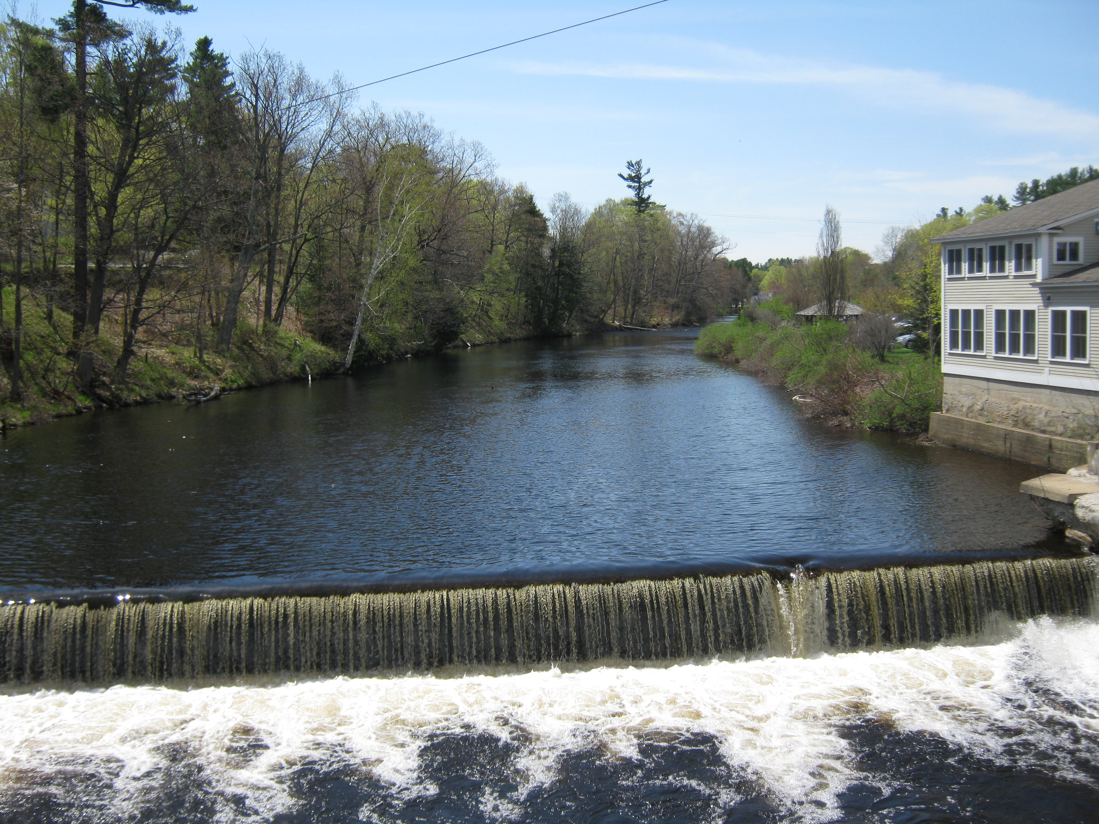
The existing timber cribbing and stone masonry Transcript Dam will be affected by this project. The eastern concrete capped stone masonry dam abutment, as well as a short segment of spillway, will be reconstructed to accommodate relocation/reconstruction of the US Route 202 retaining wall in this area. The reconstructed cast-in-place concrete eastern abutment will match the geometry and appearance of the existing abutment to the greatest extent practical. The majority of the spillway portion of the dam, as well as the river-end of the east abutment, will not be impacted by construction and therefore will not change in shape or size as part of the retaining wall work.