Summary: Other than the historical value and opportunity to ‘track bag’, Track 96 is not a particularly inspiring route. Cobbanah to Lee Creek Track is a moderate level track.Expect few views, overgrown tracks and a long steep descent. The track improves from Lee Creek Track as it turns into a benched route following Freestone Creek to Lloyd Knob picnic/camping area; moves back into the bush for 4 kilometres before hitting the road through to Blue Pool. While the road walking is not that enjoyable it is easy and offers some great views overlooking rock escarpments along Freestone Creek. The lack of photos I have of this trip says a lot – there is not much to see.
Location: 8 Kilometres north of Briagalong, Victoria
Duration: 1.5 to 2 days for full length
Distance: 60km
Difficulty: Moderate overall
Options: Track can be broken into 3 days or smaller, easier half day or day trips from Blue Pools, including a circuit to McKinnon Point. Short loop near Reedy Creek on the northern tip of the track.
Maps:
Brief History: Track 96 exists today largely through the dedicated work of the Ben Cruachan Walking Club and former Department of Natural Resources and Environment. The track was originally constructed in the late 1800’s to service gold fields between Briagalong and Gladstone Creek through to Lees Creek and Granite Creek and was serviceable through to the early 1900’s. Government maps at the time marked the track as ‘Track 96’. Following the decline of gold in these areas, the track fell into disrepair and it wasn’t until the 1990’s that efforts were made to retrace and clear the route as a walking track.
Trip Notes:
Day 1: I was dropped off at the start of the track near Cobbanah mid morning and hit the trail with a trot in my step. I was using this weekend jaunt as a training run to fully test my gear before taking on Te Araroa in New Zealand later in the year. Department of Environment crews had recently been through the first section, clearing back scrub encroaching onto the track.
Starting at the northern end, Track 96 starts with a circuit around old mining relics around Reedy Creek. The old relics are barley there and not much to look at unless your a real historical buff. Leaving the circuit walk the track continues around the contour towards Pretty Boy Hill and onto Reedy Creek Track.
Crossing Reedy Creek Track, the recent clearing works petered out and the trail while obvious became really over grown. I soon hit an old road, well overgrown and not trafficable to vehicles and a sign indicating I was on the right path. Crossing over Reedy Creek itself, Track 96 follows the faint remains of the historical track before hitting Reedy Creek Track. Here Reedy Creek Track loops widely around a steep spur line, with Track 96 ascending steeply between the loop straight up the spur. This section was really overgrown and the trail non-existent. I found it pretty funny after really bush bashing for a while to come across random directional arrow signs in the middle of the scrub, no signs of a track anywhere. The trusty map and compass didn’t fail me though.
Reaching Reedy Creek Track for a second time, Track 96 follows this for a short distance onto Budgee Track before diving back into the bush, picking up a hand cut trail that picks its way across the high knobs and saddles for around 1.5 kilometres. This section was easy enough to navigate through although really overgrown with some rocky sections. On reaching the small knob at a height of 625m the track descends very steeply down for close to 2 kilometres, the steepest section descending 200m in elevation over a 200m distance.
On reaching the bottom of the descent, Track 96 improves considerably turning into a well benched out track. From here it follows Freestone Creek all the way to Lloyds Knob although inland and uphill from the creek itself. On reaching a point where the track swings from west to south I found a nice camping spot and called it day.
Just on dusk as I was preparing my meal I got the fright of my life. Looking up from my meal I caught sight of a large dog stealthily approaching my camp. My immediate thoughts were ‘wild dog’ and I grabbed a walking pole ready to fend it off. But as it approached closer out of the gloom I found it to be a hunting dog with a radio collar around its neck – phew! Crisis averted.
Day 2: From my camp site the track continued south following Freestone Creek, still uphill and away from the river. This was an easy and pleasant section through to Freestone Track. I was running short on water and topped up while crossing Freestone Creek itself.
Track 96 then followed Freestone Track for 700m or so, passing a picnic area, and moving back into the scrub. This section of track was overgrown as well but easy to navigate. A steep climb on a long narrow spur line brings you up to a ridge where the track swings to the west again to descend down back onto Freestone Track.
From here, Track 96 follows Freestone Track itself to McKinnons Point. The road bash was easy but not particularly inspiring and I resolved to walk it fast. There were some great views down towards the creek and overlooking several escarpments with sheer walls rising from the river.
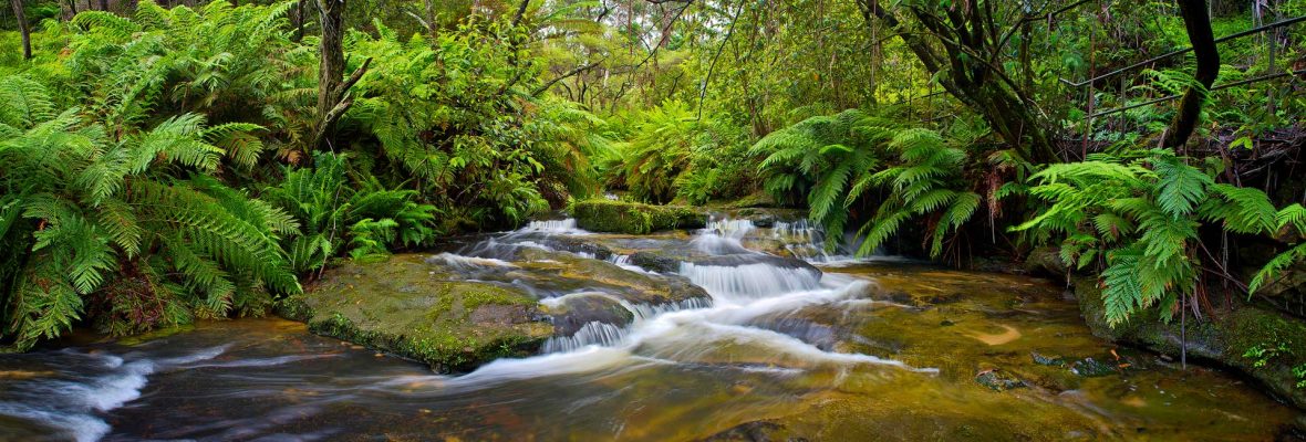
Near McKinnons Point, Track 96 picks up the circuit loops towards Blue Pool and there are several options one can take. I went with the Peregrine Circuit and Fern Gully tracks to Blue Pool, both pleasant tracks that see plenty of use and are in good knick.
By mid day I had reached Blue Pool, had some lunch and got stuck into a book while waiting for my pick up and ride back home.
