That is the question. So what does January have in store for Tahoe for 2014? There are some forecasters saying there are signs of a pattern change starting the first week of the month.
Unfortunately, the signs of a pattern adjustment from one dry pattern to another dry pattern looks more likely. With the possibility of an inside slider brushing us to our north and east around the 5th as the pattern reloads, then the high pressure ridge rebuilds off our coast keeping us dry until the second week of January. Same old song and dance basically.
The models were consistently showing a series of storms the past four days between the 7th-11th with the possibility of an AR (Atmospheric River) event occurring. I’m definitely not buying in to any of this at this time, because there are absolutely no signs in the teleconnections to support a major change.
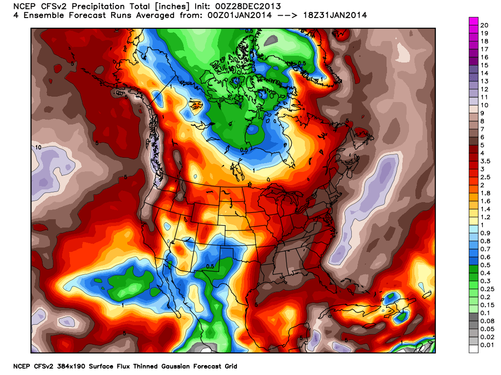
The most recent chart for January shows 5″ of liquid which at 10-1 snow ratios would be equivalent to 50″ if it was all snow. If this chart is going to materialize it’s probably not going to happen until the second week of January or beyond. I hate to say it but it seems extremely bullish, when you look at the global long wave pattern that we are currently stuck in.
We currently have three positive 500mb height anomalies (fancy way of describing a ridge of high pressure) built over three long wave troughs. The ridges are interconnected from the Alaska ridge to the North Atlantic, from the North Atlantic to the northern Asia ridge and over the pole to Alaska. This essentially locks the troughs in place over the Eastern U.S., western and central Europe, and eastern Asia. Bad news for us because this pattern locks a ridge off of the west coast.
This is an extremely stable pattern which is extremely difficult to dislodge. It is normally referred to as our January thaw. Since we have nothing to thaw it’s the “January Thawless”.
The moral of the story: no signs of hope for what appears to be another three weeks!!!