First off some housekeeping: This is the second post on the HS2 line through Measham and I have already broken the rule I set myself – a number of these images don’t look like Kodachrome 64 for two reasons: Firstly they are cropped to a square and secondly they are black and white images. Such is life.
Yesterday saw me scaling Farthing Hill whilst at the same time enjoying my other favourite pass time – bagging ancient coal pits – a very very select pastime I think you will agree. Measham has a long history of coal mining stretching back to at least the 14th century. I personally believe that it can be traced back to the Roman period but that will always be a matter of conjecture unless a coal pit is opened up and Roman finds are found at the bottom – which seems unlikely. Anyway the path from Leicester Road, Measham upto Farthing Hill goes across one of the best preserved ancient coal mining area anywhere in the country and so I had a great time checking out the earthworks some of which are the best part of 15 metres across. At the last count there are around 41 coal pits in the area – many more have been destroyed over time by large scale opencast mining that took place in the area. Nonetheless there is still quite a lot of information that can be gathered from the area.
Farthing Hill itself is never going to set the world alight when it comes to grandeur although it is the highest point in the area. It was once the border between Leicestershire and Derbyshire and the old medieval road between Derby and Oxford went over the top. There was a gallows situated on the top , although this was most likely a gibbet, hence the name Gallows Lane. Gibbets were situated on parish boundaries near to main thoroughfares as a warning to traveling criminals, although it is unclear as to how success they were a crime prevention measure. I also believe that Farthing Hill was crossed by a Roman Road which connected the Watling Street to a crossing of the River Trent ironically very close to where the HS2 will cross the river as well. I think this is what is known as continuity and change.
So once HS2 has finished with the hill it will be no more as there will be a almost 15 metre deep cutting which is going to be the best part of 50 metres wide. As for the coal pits on the side of the hill most will probably be saved from the digger as they are further away which I guess there is a certain irony in that as the English coal industry did more than any other industry to create the railways. In fact one of the earliest ever railway lines is only 8 Km to the east at Swannington. I suspect as the project develops there may well be many other ironic facts to come to light.

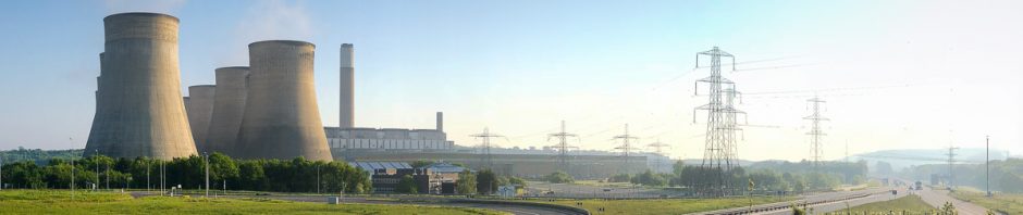
View from Farthing Hill looking northwards along the HS2 route

Farthing Hill


View from Farthing Hill along Gallows Lane – the HS2 line will run along the right hand side

Farthing Hill from Gallows Lane

Fields Farm – this will be destroyed by the HS2 cutting

And finally an old coal pit with Farthing Hill in the background
