
We are very excited to announce that Quasar Science Resources S.L., incubated by ESA BIC Madrid Region, and Wooboat are joining their forces to provide interactive maps of Posidonia meadows, as well as coral fields and other water quality assets.

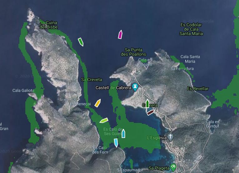
Example images of the Wooboat developed tool with the geolocation of boats combined with Quasar’s developed posidonia cartography around the island of La Cabrera, Mallorca, Spain.
The integration of periodically updated maps of Posidonia, corals or oil spills into the Wooboat PaaS MAIS is a great solution to actively protect sensitive maritime areas like unauthorized mooring.
Quasar has developed a prototype where the Posidonia cartography developed for the Balearic islands can be explored. The tool, called SIMBAD, can be found in the following link.
Recently Quasar has started developing other assets extracted from the analysis of Sentinel images that can be used for water quality control. Some news about this will come out soon ….