In 1848 The Rambler reported (on its second page 379) on the sequel to the unsuccessful Young Ireland non-event:
Mr O’Gorman [one of the leaders] is rumoured to have got on board the Jessie, which sailed from Scattery Roads, near Limerick, for Quebec, on the 8th or 9th instant. Two boatmen of Beagh Castle have been arrested, on information that they put Mr O’Gorman on board the Garryowen steamer, for Kilrush.
Richard O’Gorman did escape from Ireland and ended his career as a judge of the New York Superior Court. It is not clear whether the boatmen of Beagh Castle actually had anything to do with his escape.
Passing Beagh
In his Sights and Scenes in our Fatherland (Simpkin, Marshall & Co, London; J S Virtue; London; McGlashan & Gill, Dublin; 1863), Thomas Lacy of Wexford wrote of a passage down the estuary from Limerick:
Still down the river on the Limerick side, appears within a handsome demesne a fine house of modern aspect. Adjoining this demesne, which is designated Shannon Grove, is another pretty seat, called Castletown House. In this neighbourhood the tourist is called on to notice a very striking and interesting object, a private Lunatic Asylum. In this vicinity also appears an old ruin called Begh Castle, near to which is an ancient burial-ground. There is likewise a coast-guard station at this place […].

Castle to the right; what I guess to be coastguard cottages to the left
Navigation
The Port Information Guide for the Shannon Estuary (March 2009) says under “Passing Arrangements”:
No overtaking or passing is permitted in narrow channels. The Master of any vessel navigating between Beagh Castle and Limerick shall not overtake, or attempt to overtake another vessel proceeding in the same direction, or follow too closely in the wake of such other vessel, but if in the opinion of the Master there exists a danger to either his own or another vessel he shall be at liberty to navigate his vessel in such a manner as to obviate such risk or danger.

Beagh Castle
Commander James Wolfe mentioned the castle in his Sailing Directions for the Shannon Estuary (completed before 1848: I don’t know the exact date. These Directions have not been updated and should not be used for navigation). It occurs several times in this poetic passage:
From the Beeves to Beagh Castle (an old ruin), on the next point, called Ballyvoher, the distance is 2½ miles. Beagh Castle bears from the Beeves Tower ESE ¾ E. This portion of the river is clear of danger, taking care not to stand so far to the northward as to bring a farm-house on the profile of Aughinish Island in one with the Beeves Tower, which will keep you clear of the tail of the Horse and Mylaun’s Children at the entrance of the Fergus. Just below Beagh Castle is the termination of the three fathoms line, except in a few spots above.
Being abreast of Beagh Castle, steer up for Sod Island, which will be seen bearing E ½ N distant four miles, but keeping Aughinish Point just on with Ballyvoher Point W ¾ N, till Pickett Island is in one with a large white house, called Castletown, bearing S by W ½ W, when you will be clear of Waller Bank, a rocky patch with only three feet about a cable in length. There is a passage with nine feet between it and the low line of mud, which runs in a straight line from a little outside Beagh Castle to a little outside Ringmoylan Quay, bearing ESE ½ E 2¾ miles from the castle.
GPS waypoints just don’t have the same romance ….

Looking up the estuary from Beagh: clouds and mud. Lovely!
Google Maps doesn’t seem to be working at the moment, so here’s a link to the OSI map, centred on the pier at Beagh (which is pronounced “bay”). Zoom out to see where it is on the Shannon Estuary: on the south side, north-east of Askeaton and south-west of Shannon Airport.

Fuel tanks at Shannon Airport, barely visible in the gloom

Fuel jetty at Shannon Airport
You can see several of the features Wolfe mentioned by navigating around the area; it’s a bit tedious because (I find) you keep having to zoom in and out again, the first to read things and the second to locate them, but it’s better than having to listen to Michael Lowry TD.

Flourishing like the green Beagh tree
In 1850 it was suggested that the Transatlantic Packet Station might be located off Beagh Castle, but a small town in England, called Southampton, was chosen instead.
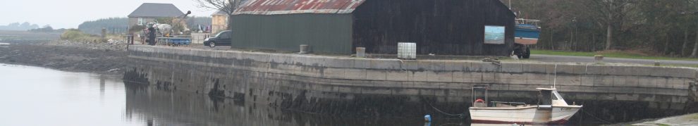
The quays
You can see from the ~1840 map (Historic 6″) that there was a quay at Beagh even then, but there was a slightly more elaborate arrangement by ~1900 (Historic 25″). The Ortho 2005 gives a good view, showing the two quays and the slipway.

The larger quay

The quay and the slipway
According to the invaluable (when it includes what you’re looking for) National Inventory of Architectural Heritage, the current quay was built in 1904:
Rusticated snecked limestone retaining walls, with limestone slipway. Parapet wall to west elevation of pier, having inscribed limestone date plaque. […]
The date plaque reads: ‘Beagh Quay built 1904 / John Horan M.E.M. INST. C.E./County Surveyor/Michael Naughton/County Councillor/William O’Neill Contractor/John Downes Foreman’.
The NIAH also mentions the limestone bollards to the east and the cast iron bollards along the main quay.

Limestone bollard, I presume
I must do a page about H Lee …. If anyone has information about the firm, I would welcome it.

The west side of the main quay
A drowning
The Annual Register for 1827 reported for 23 May:
On Wednesday (23rd), twenty-five persons went in a boat from near Beagh Castle, in the river, to collect sea-weed in the neighbouring islands, for the purposes of manure. When they were about to return, twelve of the number, alarmed by the state of the weather, determined to remain. The other thirteen, eleven men and two women, set sail in a violent gale of wind and a heavy sea. The boat was overloaded; she almost immediastely foundered, and all the thirteen perished. The bodies were washed ashore in the course of fifteen minutes.
Seaweed was widely used as manure (fertiliser) on the Shannon Estuary; here is an account of the shooting of three Askeaton men in a dispute over the collection of seaweed.
Resort
I understand that Beagh Castle (which is for sale at time of writing) is a popular spot on sunny days. Several of the features at the site may have been developed to serve those visiting for picnics and recreation.

Seat and picnic table

Steps

Shed
Estuary
But I like the grey days and the mud: what estuaries are really about.

Beach at Beagh

Buoy

Looking north beside the quay

The side of the castle

The ruined cottages
[snnest65]


It’s great to be able to find your Beagh Castle webpage.
I’ve noted my ancestor, “Sir John Fitz-John, Knight, was the first Knight of Glin, and had from his father the castles of Glincarbery and Beagh”.
http://en.wikipedia.org/wiki/Knight_of_Glin “Like the Knights of Kerry, the Knights of Glin descended from one of the younger or illegitimate sons of John FitzGerald, 1st Baron Desmond, of Shanid, County Limerick, Lord of Connelloe and Decies, married (first) Margery, daughter and heir of Sir Thomas Fitz-Anthony, Lord of Decies and Desmond. These domains were confirmed to him by Prince Edward, the Black Prince in 1260. He married (second) Honora, daughter of Hugh O’Connor of Kerry thus Kings of Connacht. Lord Desmond was also known as Sir John Fitz-John[3] or Seán Mór na Sursainge”.
I’d love to learn more about Hugh O’Connor of Kerry & O’Connor Don as clearly Beagh Castle was, is a strategic location on the River Shannon which I guess bounded the Kings of Connacht, O’Connor lands?
Enjoyed reading about Beagh. I visited askeaton last year and was very taken with the history of the area. Do you know anything about the keepers at Beeves Rock in the mid 19th century?
I don’t, I’m afraid: I haven’t [yet] researched that (I’ve been hoping to get a trip to the lighthouse at some stage, to take some photos). bjg